Area Overview for CV3 2GE
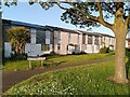
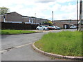
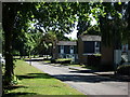
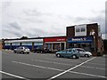
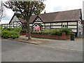
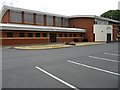
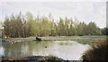
Photos of CV3 2GE
Area Information
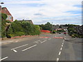
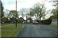
CV3 2GE lies in the south-eastern part of Coventry, within the Binley and Willenhall wards. This small postcode area covers 9,887 square metres and is home to 1,369 residents, making it one of the most densely populated parts of the city. Historically a mining village, Binley evolved into a residential district with a mix of private homes and council properties. The area is defined by its proximity to Ernesford Grange Primary School, a key local institution with a ‘good’ Ofsted rating, and its integration into Coventry’s broader urban fabric. Daily life here is shaped by its compact size and proximity to transport links, including four nearby railway stations and two airports. The community is largely composed of adults aged 30–64, reflecting a settled demographic. With broadband scores at 100 and mobile coverage at 85, residents enjoy robust digital connectivity, supporting both remote work and everyday internet use. The area’s low flood risk and crime score of 79 further underscore its appeal as a safe, functional neighbourhood. For buyers, CV3 2GE offers a blend of historical character and modern convenience, though its limited size means housing options are focused on owner-occupied properties.
- Area Type
- Postcode
- Area Size
- 9887 m²
- Population
- 1369
- Population Density
- 5561 people/km²
The property market in CV3 2GE is characterised by high home ownership (87%) and a focus on houses rather than flats or apartments. This suggests a community of long-term residents with a preference for private, detached or semi-detached homes. Given the area’s small size and high population density, the housing stock is likely limited to the existing stock of properties built during the 20th century, particularly along roads like Rugby Road and Woodlands Road. The absence of rental data implies that the market is not heavily reliant on tenants, which may affect availability for buyers seeking to move into the area. For those considering purchase, the compact nature of CV3 2GE means that properties are likely to be close to local amenities, including schools, transport links, and retail hubs. However, the limited size of the postcode area may also mean that buyers need to look beyond immediate surroundings for additional housing options.
House Prices in CV3 2GE
Showing 27 properties
| Address | Type | Beds | Baths | Last Sale Price | Last Sale Date | |
|---|---|---|---|---|---|---|
| 44 Bruntingthorpe Way, Coventry, CV3 2GE | Semi-detached | 4 | 2 | £300,000 | Oct 2024 | |
| 41 Bruntingthorpe Way, Coventry, CV3 2GE | house | - | - | £285,000 | Sep 2022 | |
| 39 Bruntingthorpe Way, Coventry, CV3 2GE | house | - | - | £250,000 | Aug 2021 | |
| 49 Bruntingthorpe Way, Coventry, CV3 2GE | Semi-detached | 3 | 1 | £190,000 | Sep 2018 | |
| 38 Bruntingthorpe Way, Coventry, CV3 2GE | Semi-detached | 3 | - | £187,000 | Oct 2015 | |
| 47 Bruntingthorpe Way, Coventry, CV3 2GE | Semi-detached | 3 | - | £150,000 | Jul 2015 | |
| 24 Bruntingthorpe Way, Coventry, CV3 2GE | Detached | 3 | 1 | £169,000 | Jun 2014 | |
| 33 Bruntingthorpe Way, Coventry, CV3 2GE | house | - | - | £145,000 | Nov 2013 | |
| 43 Bruntingthorpe Way, Coventry, CV3 2GE | Detached | 3 | 1 | £120,000 | Sep 2009 | |
| 30 Bruntingthorpe Way, Coventry, CV3 2GE | Semi-detached | 3 | 1 | £120,000 | May 2009 |
Energy Efficiency in CV3 2GE
The lifestyle in CV3 2GE is shaped by its proximity to retail, transport, and green spaces. Nearby amenities include Lidl Binley, Heron Willenhall, and Morrisons Binley, offering everyday shopping and dining options. The area’s railway stations provide easy access to Coventry’s city centre and beyond, while the presence of two airports may cater to travel needs. For leisure, residents can visit St Bartholomew’s Church, a grade I listed landmark, or explore Brandon Wood, an ancient woodland managed by the Friends of Brandon Wood. The Village Green, established in 1989, hosts community events and offers space for recreation. These amenities contribute to a balanced lifestyle, combining convenience with historical and natural features. The compact nature of the area ensures that residents can access shops, transport, and green spaces within short distances, fostering a sense of community and practicality.
Amenities
Schools
The nearest school to CV3 2GE is Ernesford Grange Primary School, which serves the local community with a ‘good’ Ofsted rating. This school is a key anchor for families in the area, providing education for younger children. The absence of secondary schools in the immediate vicinity means that students may need to travel to nearby Coventry schools, such as those in the city centre or surrounding wards. The presence of a primary school with a positive rating suggests that the area is well-served for early education, though parents seeking a full range of schooling options may need to consider proximity to secondary institutions. The school’s rating reflects a commitment to quality education, which is a significant factor for families prioritising academic outcomes.
| Rank | School | Type | Entry gender | Ages |
|---|
Explore more schools in this area
Go to Schools tabDemographics
The population of CV3 2GE is 1,369, with a median age of 47 and the majority of residents falling within the 30–64 age range. This suggests a community of established adults, many of whom are likely to be in their prime working years. Home ownership is high, at 87%, with houses being the predominant accommodation type. This indicates a stable, long-term resident base rather than a transient rental market. The predominant ethnic group is White, though no further breakdown of diversity is provided in the data. The high home ownership rate and age profile suggest a mature, low-turnover community. The area’s density—138,466 people per square kilometre—reflects its compact nature, which may influence social dynamics and access to shared amenities. While no deprivation data is available, the high home ownership and age demographics imply a relatively stable economic environment, with residents likely to have established careers and family ties.
Household Size
Accommodation Type
Tenure
Ethnic Group
Religion
Household Composition
Age
Household Deprivation
NS-SEC
Explore more demographic insights in this area
Go to Demographics tabPlanning
Planning Constraints
- Flood RiskPremium
- Ramsar Wetland SitesPremium
- Area of Outstanding Natural BeautyPremium
- Protected Nature ReservePremium
- Protected WoodlandPremium