Area Overview for CV3 2FU
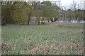
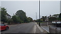
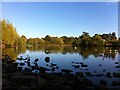
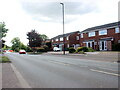
Photos of CV3 2FU
Area Information
CV3 2FU is a small, densely populated residential cluster in the south-east of Coventry, West Midlands. Covering just 2 hectares, it is home to 1,464 residents, creating a compact, closely knit community. The area evolved from historical mining villages like Binley and Willenhall, which were absorbed into Coventry’s urban fabric as the city expanded. Today, it is a predominantly residential district with a strong sense of local identity, shaped by its past as a coal-mining hub. The high population density—74,812 people per square kilometre—reflects its role as a focused living space, where daily life is centred around nearby amenities and community landmarks. While the area lacks expansive green spaces, its proximity to retail, transport, and historical sites offers a blend of convenience and heritage. For those seeking a quiet, established neighbourhood with practical access to services, CV3 2FU provides a compact, functional environment within the broader Coventry metropolitan area.
- Area Type
- Postcode
- Area Size
- 2.0 hectares
- Population
- 1464
- Population Density
- 4115 people/km²
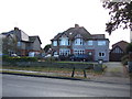
The property market in CV3 2FU is dominated by owner-occupied homes, with 86% of residents owning their properties. This high rate of home ownership suggests a stable, long-term resident base with limited rental activity. The accommodation type is primarily houses, which is unusual for a small postcode area, indicating a mix of private and council-owned properties. Given the area’s size—just 2 hectares—the housing stock is limited, making it a niche market for buyers seeking compact, established homes. The proximity to Coventry’s industrial estates, such as Herald Way, may offer opportunities for investment or second homes, though the area’s residential focus means commercial or industrial properties are rare. For buyers, the challenge lies in the limited availability of properties, requiring careful consideration of the immediate surroundings. The mix of house types and the high ownership rate suggest a market where properties retain value, but competition for available homes is likely.
House Prices in CV3 2FU
Showing 22 properties
| Address | Type | Beds | Baths | Last Sale Price | Last Sale Date | |
|---|---|---|---|---|---|---|
| 12 Cottesbrook Close, Coventry, CV3 2FU | Semi-detached | 3 | 1 | £280,000 | Sep 2024 | |
| 9 Cottesbrook Close, Coventry, CV3 2FU | Semi-detached | 3 | 1 | £315,000 | May 2024 | |
| 2 Cottesbrook Close, Coventry, CV3 2FU | house | - | - | £265,000 | Jul 2023 | |
| 4 Cottesbrook Close, Coventry, CV3 2FU | house | - | - | £290,000 | Dec 2022 | |
| 18 Cottesbrook Close, Coventry, CV3 2FU | house | - | - | £300,000 | Jul 2022 | |
| 8 Cottesbrook Close, Coventry, CV3 2FU | house | - | - | £275,000 | Aug 2021 | |
| 3 Cottesbrook Close, Coventry, CV3 2FU | Semi-detached | 3 | 1 | £230,000 | Sep 2020 | |
| 20 Cottesbrook Close, Coventry, CV3 2FU | Semi-detached | 3 | - | £155,000 | Sep 2014 | |
| 13 Cottesbrook Close, Coventry, CV3 2FU | house | - | - | £117,000 | Apr 2014 | |
| 5 Cottesbrook Close, Coventry, CV3 2FU | Semi-detached | 3 | 1 | £160,000 | Aug 2013 |
Energy Efficiency in CV3 2FU
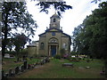
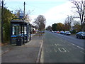
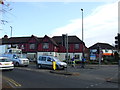
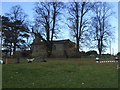
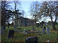
Living in CV3 2FU offers access to essential retail and transport hubs within practical reach. The area is served by five retail outlets, including Budgens Aldermoor, Heron Willenhall, and Lidl Binley, providing everyday shopping convenience. Two airports and four railway stations ensure connectivity to regional and national destinations, making travel straightforward. While the area’s compact size limits expansive leisure options, its proximity to Coventry’s urban core means residents can access cultural, recreational, and commercial facilities in the city. The historical and social fabric of the area, including landmarks like St Bartholomew’s Church and community spaces like the Coombe Social Club, adds to its character. However, the lack of detailed data on parks or green spaces means outdoor recreation may require travel to nearby areas. Overall, the lifestyle in CV3 2FU balances practicality with the charm of a historic, tightly woven community.
Amenities
Schools
| Rank | School | Type | Entry gender | Ages |
|---|
Explore more schools in this area
Go to Schools tabDemographics
The population of CV3 2FU is 1,464, with a median age of 47, indicating a mature demographic skewed toward adults aged 30–64. This age group constitutes the majority, suggesting a community rooted in stability and experience. Home ownership is exceptionally high at 86%, with the predominant accommodation type being houses rather than flats. The area is overwhelmingly White, reflecting a homogenous ethnic profile. The high home ownership rate and older age demographic imply a long-term presence of residents, with limited turnover. This stability contributes to a cohesive neighbourhood dynamic. However, the lack of diversity in ethnicity and the absence of specific data on deprivation mean the area’s socioeconomic challenges remain unclear. The density of 74,812 people per square kilometre further underscores the compact nature of the community, where proximity to services and social networks is a defining feature.
Household Size
Accommodation Type
Tenure
Ethnic Group
Religion
Household Composition
Age
Household Deprivation
NS-SEC
Explore more demographic insights in this area
Go to Demographics tabPlanning
Planning Constraints
- Flood RiskPremium
- Ramsar Wetland SitesPremium
- Area of Outstanding Natural BeautyPremium
- Protected Nature ReservePremium
- Protected WoodlandPremium