Area Overview for CV3 1ND
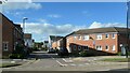
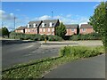
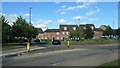
Photos of CV3 1ND


Area Information
CV3 1ND lies within Coventry’s Lower Stoke Ward, a small residential cluster in the West Midlands. With a population of 2,799, it is a compact area shaped by its industrial past and recent redevelopment. The postcode covers a mix of housing and light industry, divided by the Coventry-Rugby railway line. Historically tied to Saxon origins and 13th-century landholdings, the area evolved through car manufacturing in the 20th century, with sites like the former Humber and Peugeot factories now redeveloped for housing. Today, it balances older industrial estates with newer residential builds, creating a community of around 2,800 people. The median age of 47 suggests a mature demographic, with adults aged 30–64 forming the largest group. Living here means proximity to Coventry’s city centre, with easy access to rail links and two airports. The area’s character is defined by its industrial heritage and practical layout, offering a blend of convenience and historical context for residents.
- Area Type
- Postcode
- Area Size
- Not available
- Population
- Not available
- Population Density
- Not available
The property market in CV3 1ND is characterised by a 50% home ownership rate, with houses forming the majority of accommodation types. This suggests a mix of owner-occupied and rental properties, though the exact proportion of rentals is unspecified. The area’s housing stock reflects its dual history of industrial use and recent residential redevelopment. Northern parts, once home to car manufacturing sites like Humber and Peugeot, now host newer housing developments. Southern areas retain older industrial estates and warehouses, which may be repurposed for commercial or mixed-use. For buyers, this means a small area with varied property types, but limited scale. Proximity to Coventry’s city centre and rail links adds appeal, though the compact nature of the postcode means competition for available homes. Investors should consider the area’s industrial legacy and potential for further redevelopment.
House Prices in CV3 1ND
No properties found in this postcode.
Energy Efficiency in CV3 1ND
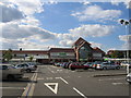
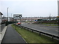
Residents of CV3 1ND have access to a range of nearby amenities within practical reach. Retail options include Asda Abbey, Budgens Aldermoor, and Co-op Humber, providing essential shopping for daily needs. The area’s rail network offers five stations, including Canley and Coventry Arena, connecting residents to Coventry’s city centre, employment hubs, and regional destinations. While no parks or leisure facilities are explicitly listed, the proximity to Coventry’s urban core suggests access to larger recreational spaces. The industrial heritage of the area is evident in its landscape, but the presence of retail and transport links ensures convenience. For those prioritising accessibility, the combination of retail, rail, and airports makes CV3 1ND a practical choice, though the lack of dedicated leisure amenities may require travel to nearby areas.
Amenities
Schools
| Rank | School | Type | Entry gender | Ages |
|---|
Explore more schools in this area
Go to Schools tabDemographics
The population of CV3 1ND is 2,799, with a median age of 47. This indicates a community skewed toward middle-aged adults, with 30–64-year-olds making up the largest age group. Home ownership stands at 50%, suggesting a balance between owner-occupied properties and rental housing. The area is predominantly composed of houses, reflecting a traditional housing stock rather than flats or apartments. The predominant ethnic group is White, though no specific diversity statistics are provided. The demographic profile suggests a stable, established population with fewer young families or elderly residents. With no data on deprivation levels, it is unclear how this affects local services or quality of life. However, the age profile implies a community with established routines, potentially focused on work and retirement rather than childcare or education.
Household Size
Accommodation Type
Tenure
Ethnic Group
Religion
Household Composition
Age
Household Deprivation
NS-SEC
Explore more demographic insights in this area
Go to Demographics tabPlanning
Planning Constraints
- Flood RiskPremium
- Ramsar Wetland SitesPremium
- Area of Outstanding Natural BeautyPremium
- Protected Nature ReservePremium
- Protected WoodlandPremium