Area Overview for CV3 1LU
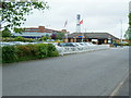
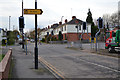
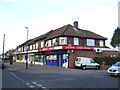
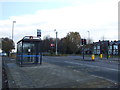
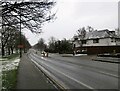
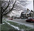
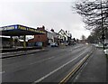
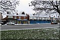
Photos of CV3 1LU


Area Information
Living in CV3 1LU means being part of a tightly knit residential cluster in Lower Stoke Ward, Coventry. This area, covering 1,270 square metres, is home to 2,798 people, creating a densely populated environment with a population density of over 2.2 million per square kilometre. The area’s character is shaped by its proximity to Coventry city centre and its historical roots as a light industrial zone. Recent redevelopment has transformed parts of the northern side into housing, while the southern areas retain older industrial estates and offices. The Coventry-Rugby railway line slices through the district, linking residents to broader transport networks. Daily life here is influenced by its mix of residential and industrial spaces, with a median age of 47 and a community skewed toward adults aged 30–64. The area’s compact size means amenities and services are within practical reach, though its density demands a focus on efficient living. For buyers, CV3 1LU offers a blend of established housing and proximity to urban infrastructure, though the lack of major green spaces or historic sites reflects its utilitarian character.
- Area Type
- Postcode
- Area Size
- 1270 m²
- Population
- Not available
- Population Density
- Not available
The property market in CV3 1LU is dominated by owner-occupied homes, with 70% of properties owned by residents rather than rented. The accommodation type is primarily houses, which is unusual for a small, densely populated area. This suggests a mix of older, established homes and newer developments, particularly on the northern side, where former industrial sites have been redeveloped for residential use. The limited area size means the housing stock is constrained, and buyers should consider proximity to the railway line and industrial zones. While the area lacks luxury properties or high-end developments, its affordability and proximity to Coventry’s infrastructure may appeal to those prioritising practicality over prestige. The predominance of houses over flats or apartments indicates a community focused on family living, though the compact nature of the area may limit outdoor space.
House Prices in CV3 1LU
Showing 6 properties
| Address | Type | Beds | Baths | Last Sale Price | Last Sale Date | |
|---|---|---|---|---|---|---|
| 3 Matilda Mews, Stoke, Coventry, CV3 1LU | Detached | 3 | 3 | £335,000 | Jun 2025 | |
| 1 Matilda Mews, Stoke, Coventry, CV3 1LU | house | - | - | £298,000 | Jan 2022 | |
| 2 Matilda Mews, Stoke, Coventry, CV3 1LU | Detached | 3 | 2 | £255,000 | Dec 2020 | |
| 6 Matilda Mews, Stoke, Coventry, CV3 1LU | house | 3 | 1 | £168,950 | Dec 2013 | |
| 8 Matilda Mews, Stoke, Coventry, CV3 1LU | Detached | 3 | 2 | £168,950 | Dec 2013 | |
| 4 Matilda Mews, Stoke, Coventry, CV3 1LU | house | - | - | £168,950 | Dec 2013 |
Energy Efficiency in CV3 1LU
The lifestyle in CV3 1LU is shaped by its proximity to retail, transport, and industrial hubs. Nearby amenities include five retail outlets, such as Lidl Upper, Iceland Binley, and Budgens Aldermoor, offering everyday shopping convenience. The area’s rail network, with five stations including Coventry Arena and Bedworth, provides easy access to Coventry’s cultural and commercial centres. While the data does not mention parks or leisure facilities, the area’s industrial past and compact layout suggest a focus on practicality over leisure. Residents can access two airports, though their relevance to daily life is unclear. The mix of retail, transport, and industrial spaces creates a functional environment, though the lack of green spaces or recreational amenities may be a drawback for those prioritising outdoor activities.
Amenities
Schools
The nearest school to CV3 1LU is Pattison College, an independent institution. No other schools are listed in the data, meaning families relying on state education may need to look beyond the immediate area. Pattison College’s independent status implies it is likely a private or selective school, which could be a draw for families seeking specific educational pathways. However, the absence of state schools in the immediate vicinity suggests that parents should investigate nearby options in Coventry or surrounding areas. The single school listed reflects the area’s small size and limited educational infrastructure, which may be a consideration for families prioritising school choice.
| Rank | School | Type | Entry gender | Ages |
|---|
Explore more schools in this area
Go to Schools tabDemographics
The population of CV3 1LU is predominantly adults aged 30–64, with a median age of 47. This suggests a mature community, likely with established careers and families. Home ownership is high at 70%, indicating a stable, long-term resident base. The accommodation type is primarily houses, which aligns with the area’s residential focus. The predominant ethnic group is White, though no specific data on diversity or deprivation is provided. The high population density—over 2.2 million people per square kilometre—means services and amenities are closely packed, but it also implies limited space for expansion. For quality of life, this density could mean shorter commutes and accessible services, though it may also contribute to a sense of overcrowding. The absence of specific deprivation metrics means the area’s socio-economic challenges remain unquantified, but the high home ownership rate suggests a relatively stable financial environment.
Household Size
Accommodation Type
Tenure
Ethnic Group
Religion
Household Composition
Age
Household Deprivation
NS-SEC
Explore more demographic insights in this area
Go to Demographics tabPlanning
Planning Constraints
- Flood RiskPremium
- Ramsar Wetland SitesPremium
- Area of Outstanding Natural BeautyPremium
- Protected Nature ReservePremium
- Protected WoodlandPremium