Area Overview for CV3 1JW
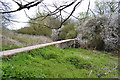
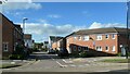
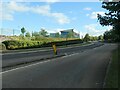
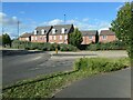
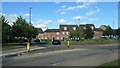
Photos of CV3 1JW


Area Information
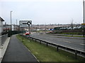
CV3 1JW is a small, densely populated residential postcode area in Coventry, England, covering 6,018 square metres and home to 2,799 residents. Its compact size and high population density of 465,129 people per square kilometre reflect a tightly knit community. Situated in Lower Stoke Ward, the area straddles the Coventry-Rugby railway line, with newer housing developments to the north and older industrial zones to the south. Historically shaped by car manufacturing, the area now balances residential living with remnants of its industrial past. The median age of 47 suggests a mature demographic, with adults aged 30–64 forming the largest group. Predominantly White residents live in houses, with half owning their homes. Daily life here is defined by proximity to the city centre, rail links, and a mix of retail and transport hubs. The area’s character is shaped by its history—once agricultural, then industrial, now evolving into a residential enclave with a practical, no-frills appeal for those prioritising connectivity over heritage.
- Area Type
- Postcode
- Area Size
- 6018 m²
- Population
- Not available
- Population Density
- Not available
The property market in CV3 1JW is characterised by a 50% home ownership rate, indicating a mix of owner-occupied and rental properties. The area’s accommodation is predominantly houses, reflecting a preference for larger, family-oriented homes. Given the postcode’s small size and high density, the housing stock is limited, with developments concentrated in two distinct phases: newer residential areas north of the Coventry-Rugby railway line and older industrial estates to the south. This duality suggests a transition from former manufacturing sites to residential use, particularly in the north, where housing replaced car factories. For buyers, this means a focus on properties in the newer developments, which may offer modern amenities, though the overall market is constrained by the area’s compact footprint. The proximity to rail links and the city centre could enhance property value, but the lack of significant green spaces or historic features may limit appeal for buyers prioritising heritage or expansive outdoor areas.
House Prices in CV3 1JW
Showing 7 properties
| Address | Type | Beds | Baths | Last Sale Price | Last Sale Date | |
|---|---|---|---|---|---|---|
| Apartment 1, Jennings House, 34 Carter Road, Coventry, CV3 1JW | Flat | - | - | - | - | |
| 6, Jennings House, 34 Carter Road, Coventry, CV3 1JW | Flat | - | - | - | - | |
| 1, Jennings House, 34 Carter Road, Coventry, CV3 1JW | Flat | - | - | - | - | |
| 5, Jennings House, 34 Carter Road, Coventry, CV3 1JW | Flat | - | - | - | - | |
| 4, Jennings House, 34 Carter Road, Coventry, CV3 1JW | Flat | - | - | - | - | |
| 3, Jennings House, 34 Carter Road, Coventry, CV3 1JW | Flat | - | - | - | - | |
| 2, Jennings House, 34 Carter Road, Coventry, CV3 1JW | Flat | - | - | - | - |
Energy Efficiency in CV3 1JW
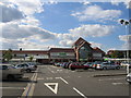
Living in CV3 1JW offers access to a range of local amenities within practical reach. Retail options include Budgens Aldermoor, Asda Abbey, and Co-op Humber, providing everyday shopping needs. The area’s rail connections—such as Canley Railway Station and Tile Hill Railway Station—facilitate easy travel to Coventry’s cultural and commercial hubs. While there are no named parks or leisure facilities listed, the proximity to the Coventry-Rugby railway line and the city’s broader infrastructure suggests opportunities for recreation in nearby green spaces or public parks. The presence of two airports, though not elaborated on, may appeal to frequent travellers. The area’s compact nature means amenities are concentrated, requiring residents to plan for nearby destinations for more specialised services. Nonetheless, the combination of retail, rail, and transport links creates a functional lifestyle, ideal for those prioritising convenience and connectivity over expansive leisure options.
Amenities
Schools
| Rank | School | Type | Entry gender | Ages |
|---|
Explore more schools in this area
Go to Schools tabDemographics
The population of CV3 1JW is 2,799, with a median age of 47, indicating a mature community where adults aged 30–64 make up the largest age group. Home ownership is at 50%, suggesting a balance between owner-occupied and rental properties. The area is predominantly composed of houses, reflecting a preference for family-friendly or larger living spaces. The predominant ethnic group is White, with no specific data on other demographics. The high population density of 465,129 people per square kilometre implies a compact, closely packed residential environment. This density may influence local services and amenities, requiring efficient infrastructure to meet demand. The absence of detailed diversity statistics means the community’s social fabric is largely defined by its core demographic. For residents, this translates to a stable, familiar environment with limited cultural or ethnic variety, which may appeal to those seeking a traditional, homogenous community.
Household Size
Accommodation Type
Tenure
Ethnic Group
Religion
Household Composition
Age
Household Deprivation
NS-SEC
Explore more demographic insights in this area
Go to Demographics tabPlanning
Planning Constraints
- Flood RiskPremium
- Ramsar Wetland SitesPremium
- Area of Outstanding Natural BeautyPremium
- Protected Nature ReservePremium
- Protected WoodlandPremium