Area Overview for CV3 1JH
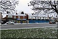
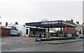
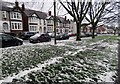
Photos of CV3 1JH

Area Information
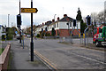
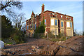
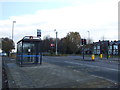
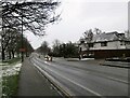
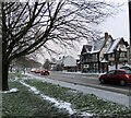
CV3 1JH is a compact residential postcode area in Coventry, England, covering just 1.6 hectares and home to 2,798 people. Its high population density—176,885 people per square kilometre—reflects a tightly packed, urbanised environment. Situated in Lower Stoke Ward, the area lies to the south-east of Coventry city centre, bisected by the Coventry-Rugby railway line. Historically shaped by car manufacturing, the landscape today blends newer housing developments with remnants of industrial activity. The northern part of the area, once occupied by car factories like Humber and Peugeot, now hosts residential properties, while the south retains light industry and offices. Proximity to Coventry’s core offers easy access to the city’s amenities, though the area’s character is defined by its small-scale, closely spaced housing and limited green spaces. For buyers, CV3 1JH represents a compact, high-density living option near transport links, though its industrial past and lack of major natural features may appeal to those prioritising convenience over heritage.
- Area Type
- Postcode
- Area Size
- 1.6 hectares
- Population
- Not available
- Population Density
- Not available
The property market in CV3 1JH is dominated by owner-occupied homes, with 70% of residents living in their own properties. The area’s housing stock consists primarily of houses, reflecting a focus on single-family dwellings rather than apartments or terraced units. Given the postcode’s small size—just 1.6 hectares—the housing supply is limited, which may drive competition among buyers. The mix of newer residential developments and older industrial conversions suggests a varied property landscape, though the lack of listed buildings or historic features means architectural diversity is minimal. For buyers, the area’s proximity to Coventry’s transport network and retail amenities could offset its compact nature, but the high population density may limit options for those seeking larger properties or outdoor space.
House Prices in CV3 1JH
Showing 26 properties
| Address | Type | Beds | Baths | Last Sale Price | Last Sale Date | |
|---|---|---|---|---|---|---|
| 3 Isadora Lea, Coventry, CV3 1JH | Terraced | 3 | 1 | £390,000 | Aug 2024 | |
| 4 Isadora Lea, Coventry, CV3 1JH | house | - | - | £260,000 | Jun 2014 | |
| 2 Isadora Lea, Coventry, CV3 1JH | Detached | 3 | 2 | £212,500 | May 2014 | |
| 1 Isadora Lea, Coventry, CV3 1JH | Detached | 4 | 3 | £259,950 | May 2014 | |
| 6 Isadora Lea, Coventry, CV3 1JH | Semi-detached | 3 | 2 | £286,000 | May 2014 | |
| 20 Isadora Lea, Coventry, CV3 1JH | Detached | 4 | 2 | - | - | |
| 21 Isadora Lea, Coventry, CV3 1JH | Detached | - | - | - | - | |
| 34 Isadora Lea, Coventry, CV3 1JH | Detached | - | - | - | - | |
| 44 Isadora Lea, Coventry, CV3 1JH | Detached | - | - | - | - | |
| 19 Isadora Lea, Coventry, CV3 1JH | Detached | - | - | - | - |
Energy Efficiency in CV3 1JH
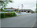
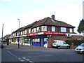
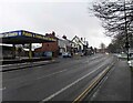
The lifestyle in CV3 1JH is defined by its proximity to practical amenities. Retail options include Budgens Aldermoor, Lidl Upper, and Iceland Binley, offering everyday shopping needs. The area’s rail stations—Canley, Coventry Arena, and Bedworth—provide direct links to Coventry’s business district and beyond. While there are no named parks or leisure facilities in the data, the area’s industrial heritage and compact layout suggest a focus on functional living over recreational spaces. The presence of two airports, though unspecified in detail, may appeal to those with travel needs. Overall, CV3 1JH offers convenience through its retail and transport networks, though the lack of green spaces or cultural amenities may require residents to seek entertainment elsewhere.
Amenities
Schools
The nearest school to CV3 1JH is Pattison College, an independent institution. The absence of state schools in the data means the area’s educational options are limited to private provision. For families prioritising independent education, Pattison College may be a draw, though its specific Ofsted rating is not provided. The lack of nearby state schools could be a concern for those seeking more affordable or diverse educational choices. The single school type in the area suggests a narrow focus on private education, which may not align with the needs of all households. Prospective buyers should consider whether the absence of state schools and the specific offerings of Pattison College meet their children’s requirements.
| Rank | School | Type | Entry gender | Ages |
|---|
Explore more schools in this area
Go to Schools tabDemographics
The population of CV3 1JH skews older, with a median age of 47 and the majority of residents aged 30–64. Home ownership is high at 70%, reflecting a community of long-term residents rather than renters. The area is predominantly occupied by houses, and the predominant ethnic group is White. The population density of 176,885 people per square kilometre indicates a very compact living environment, where proximity to neighbours and amenities is almost guaranteed. This density may contribute to a sense of community but could also mean limited private space. The age profile suggests a stable demographic, with fewer young families or elderly residents compared to other areas. The absence of specific deprivation data means quality of life factors like access to services and transport are key considerations for potential buyers.
Household Size
Accommodation Type
Tenure
Ethnic Group
Religion
Household Composition
Age
Household Deprivation
NS-SEC
Explore more demographic insights in this area
Go to Demographics tabPlanning
Planning Constraints
- Flood RiskPremium
- Ramsar Wetland SitesPremium
- Area of Outstanding Natural BeautyPremium
- Protected Nature ReservePremium
- Protected WoodlandPremium