Area Overview for CV23 9HN
Photos of CV23 9HN

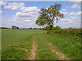

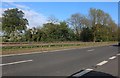
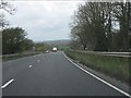
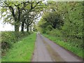


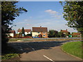
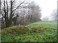
11 photos from this area
Area Information
Key information about the CV23 9HN including its size, population, and administrative classification.
- Area Type
- Postcode
- Area Size
- 32.4 hectares
- Population
- 1648
- Population Density
- 151 people/km²
House Prices in CV23 9HN
16
Properties
£347,400
Average Sold Price
£110,000
Lowest Price
£450,000
Highest Price
Showing 16 properties
| Address | Type | Beds | Baths | Last Sale Price | Last Sale Date | |
|---|---|---|---|---|---|---|
| 472 London Road, Stretton On Dunsmore, CV23 9HN | Cottage | 2 | 1 | £110,000 | Jul 2023 | |
| 464 London Road, Stretton On Dunsmore, CV23 9HN | Terraced | 2 | 1 | £345,000 | Feb 2023 | |
| 476 London Road, Stretton On Dunsmore, CV23 9HN | Detached | 4 | 1 | £448,000 | Sep 2020 | |
| 468 London Road, Stretton On Dunsmore, CV23 9HN | house | 4 | - | £450,000 | Mar 2017 | |
| 430 London Road, Stretton On Dunsmore, CV23 9HN | Detached | 4 | 2 | £384,000 | Dec 2015 | |
| The Laurels, 434 London Road, Stretton On Dunsmore, CV23 9HN | Detached | 4 | 3 | - | - | |
| The Reynolds, 458 London Road, Stretton On Dunsmore, CV23 9HN | Detached | 5 | 2 | - | - | |
| The Quest, 460 London Road, Stretton On Dunsmore, CV23 9HN | Detached | 5 | 3 | - | - | |
| 470 London Road, Stretton On Dunsmore, CV23 9HN | Semi-detached | 2 | 1 | - | - | |
| Eddies Lot, 438 London Road, Stretton On Dunsmore, CV23 9HN | Cottage | 6 | 3 | - | - |
Page 1 of 2
Energy Efficiency in CV23 9HN
Amenities
Schools
| Rank | School | Type | Entry gender | Ages |
|---|
Explore more schools in this area
Go to Schools tabDemographics
Household Size
Two person
most common
Accommodation Type
Houses
most common
Tenure
69
majority
Ethnic Group
White
most common
Religion
N/A
most common
Household Composition
N/A
most common
Age
47
median
Adults (30-64 years)
most common
Household Deprivation
N/A
with no deprivation
NS-SEC
37
in Lower managerial occupations
Explore more demographic insights in this area
Go to Demographics tabPlanning
Planning Constraints
- Flood RiskPremium
- Ramsar Wetland SitesPremium
- Area of Outstanding Natural BeautyPremium
- Protected Nature ReservePremium
- Protected WoodlandPremium