Area Overview for CV23 9HB
Photos of CV23 9HB
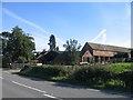
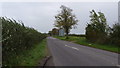
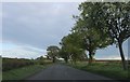
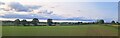
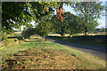
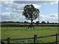
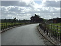
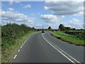
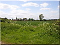
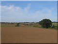
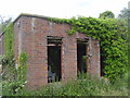
11 photos from this area
Area Information
Key information about the CV23 9HB including its size, population, and administrative classification.
- Area Type
- Postcode
- Area Size
- 1.2 km²
- Population
- 1609
- Population Density
- 105 people/km²
House Prices in CV23 9HB
16
Properties
£450,000
Average Sold Price
£445,000
Lowest Price
£455,000
Highest Price
Showing 16 properties
| Address | Type | Beds | Baths | Last Sale Price | Last Sale Date | |
|---|---|---|---|---|---|---|
| Bramley House, Coventry Road, Church Lawford, CV23 9HB | house | - | - | £455,000 | Aug 2009 | |
| Thornhill, Coventry Road, Church Lawford, CV23 9HB | Bungalow | - | - | £445,000 | Mar 2006 | |
| The Grange, Coventry Road, Church Lawford, CV23 9HB | undefined | - | - | - | - | |
| Vicarage View, Coventry Road, Church Lawford, CV23 9HB | Flat | 2 | 1 | - | - | |
| Vicarage Farm Cattery Limited, Vicarage Farm Cattery, Vicarage Farm, Coventry Road, Church Lawford, CV23 9HB | commercial | - | - | - | - | |
| Ivy Cottage, Coventry Road, Church Lawford, CV23 9HB | undefined | - | - | - | - | |
| 2, Grange Cottage, Coventry Road, Church Lawford, CV23 9HB | Semi-detached | - | - | - | - | |
| Avon Cottage, Coventry Road, Church Lawford, CV23 9HB | Cottage | 3 | - | - | - | |
| Grange Farm, Coventry Road, Church Lawford, CV23 9HB | Semi-detached | - | - | - | - | |
| Cottage Farm, Coventry Road, Church Lawford, CV23 9HB | Detached | - | - | - | - |
Page 1 of 2
Energy Efficiency in CV23 9HB
Amenities
Schools
| Rank | School | Type | Entry gender | Ages |
|---|
Explore more schools in this area
Go to Schools tabDemographics
Household Size
Two person
most common
Accommodation Type
Houses
most common
Tenure
62
majority
Ethnic Group
White
most common
Religion
N/A
most common
Household Composition
N/A
most common
Age
47
median
Adults (30-64 years)
most common
Household Deprivation
N/A
with no deprivation
NS-SEC
28
in Lower managerial occupations
Explore more demographic insights in this area
Go to Demographics tabPlanning
Planning Constraints
- Flood RiskPremium
- Ramsar Wetland SitesPremium
- Area of Outstanding Natural BeautyPremium
- Protected Nature ReservePremium
- Protected WoodlandPremium