Area Overview for CV23 0QF
Photos of CV23 0QF
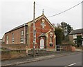
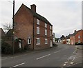
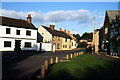
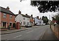
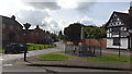
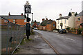
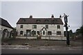
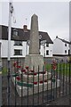
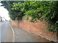
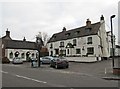
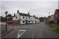
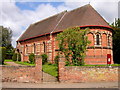
17 photos from this area
Area Information
Key information about the CV23 0QF including its size, population, and administrative classification.
- Area Type
- Postcode
- Area Size
- 45.0 hectares
- Population
- 2099
- Population Density
- 54 people/km²
House Prices in CV23 0QF
23
Properties
£258,445
Average Sold Price
£75,000
Lowest Price
£470,000
Highest Price
Showing 23 properties
| Address | Type | Beds | Baths | Last Sale Price | Last Sale Date | |
|---|---|---|---|---|---|---|
| 39 Lutterworth Road, Pailton, CV23 0QF | house | - | - | £350,000 | Sep 2021 | |
| 31 Lutterworth Road, Pailton, CV23 0QF | house | - | - | £275,000 | Sep 2017 | |
| 47 Lutterworth Road, Pailton, CV23 0QF | house | - | - | £250,000 | Sep 2017 | |
| 52 Lutterworth Road, Pailton, CV23 0QF | house | - | - | £357,500 | Jul 2016 | |
| 45 Lutterworth Road, Pailton, CV23 0QF | house | 3 | 2 | £180,000 | Apr 2008 | |
| 66 Lutterworth Road, Pailton, CV23 0QF | Detached | - | - | £299,950 | Aug 2006 | |
| 56 Lutterworth Road, Pailton, CV23 0QF | Detached | 5 | 3 | £470,000 | Oct 2005 | |
| 72 Lutterworth Road, Pailton, CV23 0QF | Semi-detached | - | - | £75,000 | Aug 2000 | |
| Barnhey, 58 Lutterworth Road, Pailton, CV23 0QF | Semi-detached | - | - | £200,000 | Dec 1998 | |
| 54 Lutterworth Road, Pailton, CV23 0QF | house | - | - | £127,000 | Jun 1995 |
Page 1 of 3
Energy Efficiency in CV23 0QF
Amenities
Schools
| Rank | School | Type | Entry gender | Ages |
|---|
Explore more schools in this area
Go to Schools tabDemographics
Household Size
Two person
most common
Accommodation Type
Houses
most common
Tenure
75
majority
Ethnic Group
White
most common
Religion
N/A
most common
Household Composition
N/A
most common
Age
47
median
Adults (30-64 years)
most common
Household Deprivation
N/A
with no deprivation
NS-SEC
42
in Lower managerial occupations
Explore more demographic insights in this area
Go to Demographics tabPlanning
Planning Constraints
- Flood RiskPremium
- Ramsar Wetland SitesPremium
- Area of Outstanding Natural BeautyPremium
- Protected Nature ReservePremium
- Protected WoodlandPremium