Area Overview for CV23 0HS
Photos of CV23 0HS


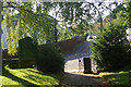
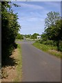
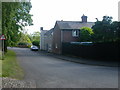
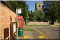
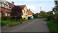
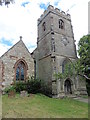
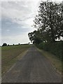
26 photos from this area
Area Information
Key information about the CV23 0HS including its size, population, and administrative classification.
- Area Type
- Postcode
- Area Size
- 18.1 hectares
- Population
- 1485
- Population Density
- 71 people/km²
House Prices in CV23 0HS
42
Properties
£493,346
Average Sold Price
£79,950
Lowest Price
£1,291,500
Highest Price
Showing 42 properties
| Address | Type | Beds | Baths | Last Sale Price | Last Sale Date | |
|---|---|---|---|---|---|---|
| Church Farm, Main Street, Harborough Magna, CV23 0HS | house | 5 | 4 | £1,291,500 | Mar 2024 | |
| The Smithy, Main Street, Harborough Magna, CV23 0HS | Detached | 4 | 2 | £597,550 | Oct 2021 | |
| Manor House, Main Street, Harborough Magna, CV23 0HS | Semi-detached | 2 | - | £1,275,000 | Feb 2021 | |
| The Laurels, Main Street, Harborough Magna, CV23 0HS | Detached | 4 | - | £617,500 | Feb 2021 | |
| The Cedars, Main Street, Harborough Magna, CV23 0HS | house | - | - | £394,000 | Oct 2019 | |
| Four Horseshoes, Main Street, Harborough Magna, CV23 0HS | Terraced | 2 | - | £110,500 | Apr 2015 | |
| Croft Field, Main Street, Harborough Magna, CV23 0HS | house | - | - | £305,000 | Dec 2012 | |
| Meadow View, Main Street, Harborough Magna, CV23 0HS | Bungalow | - | - | £390,000 | Aug 2010 | |
| Rose Cottage, Main Street, Harborough Magna, CV23 0HS | Detached | - | - | £270,000 | May 2008 | |
| Holly Barn, Main Street, Harborough Magna, CV23 0HS | Detached | - | - | £417,500 | Sep 2007 |
Page 1 of 5
Energy Efficiency in CV23 0HS
Amenities
Schools
| Rank | School | Type | Entry gender | Ages |
|---|
Explore more schools in this area
Go to Schools tabDemographics
Household Size
Two person
most common
Accommodation Type
Houses
most common
Tenure
81
majority
Ethnic Group
White
most common
Religion
N/A
most common
Household Composition
N/A
most common
Age
47
median
Adults (30-64 years)
most common
Household Deprivation
N/A
with no deprivation
NS-SEC
46
in Lower managerial occupations
Explore more demographic insights in this area
Go to Demographics tabPlanning
Planning Constraints
- Flood RiskPremium
- Ramsar Wetland SitesPremium
- Area of Outstanding Natural BeautyPremium
- Protected Nature ReservePremium
- Protected WoodlandPremium