Area Overview for CV22 7AQ
Photos of CV22 7AQ
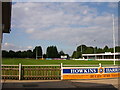
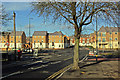
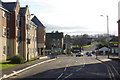
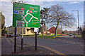
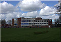
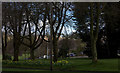
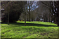
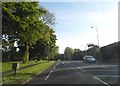
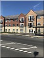
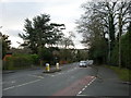
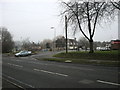
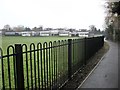
35 photos from this area
Area Information
Key information about the CV22 7AQ including its size, population, and administrative classification.
- Area Type
- Postcode
- Area Size
- 1.2 hectares
- Population
- 1369
- Population Density
- 3306 people/km²
House Prices in CV22 7AQ
32
Properties
£172,726
Average Sold Price
£71,000
Lowest Price
£250,000
Highest Price
Showing 32 properties
| Address | Type | Beds | Baths | Last Sale Price | Last Sale Date | |
|---|---|---|---|---|---|---|
| 50 Firs Drive, Bilton, Rugby, CV22 7AQ | Detached | 3 | 1 | £245,000 | Aug 2025 | |
| 86 Firs Drive, Bilton, Rugby, CV22 7AQ | Semi-detached | 2 | 1 | £225,400 | Jan 2025 | |
| 8 Firs Drive, Bilton, Rugby, CV22 7AQ | Semi-detached | 3 | 2 | £250,000 | Dec 2022 | |
| 28 Firs Drive, Bilton, Rugby, CV22 7AQ | house | - | - | £232,500 | Feb 2022 | |
| 44 Firs Drive, Bilton, Rugby, CV22 7AQ | Semi-detached | 2 | 1 | £232,500 | Oct 2020 | |
| 20 Firs Drive, Bilton, Rugby, CV22 7AQ | Semi-detached | 3 | 1 | £190,000 | Aug 2020 | |
| 94 Firs Drive, Bilton, Rugby, CV22 7AQ | Semi-detached | 2 | 1 | £200,000 | Dec 2019 | |
| 10 Firs Drive, Bilton, Rugby, CV22 7AQ | Semi-detached | 2 | 1 | £243,000 | Dec 2019 | |
| 26 Firs Drive, Bilton, Rugby, CV22 7AQ | Semi-detached | 3 | 1 | £182,000 | Sep 2017 | |
| 92 Firs Drive, Bilton, Rugby, CV22 7AQ | Semi-detached | 3 | 1 | £210,000 | Dec 2016 |
Page 1 of 4
Energy Efficiency in CV22 7AQ
Amenities
Schools
| Rank | School | Type | Entry gender | Ages |
|---|
Explore more schools in this area
Go to Schools tabDemographics
Household Size
Two person
most common
Accommodation Type
Houses
most common
Tenure
75
majority
Ethnic Group
White
most common
Religion
N/A
most common
Household Composition
N/A
most common
Age
47
median
Adults (30-64 years)
most common
Household Deprivation
N/A
with no deprivation
NS-SEC
32
in Lower managerial occupations
Explore more demographic insights in this area
Go to Demographics tabPlanning
Planning Constraints
- Flood RiskPremium
- Ramsar Wetland SitesPremium
- Area of Outstanding Natural BeautyPremium
- Protected Nature ReservePremium
- Protected WoodlandPremium