Area Overview for CV22 6JT
Photos of CV22 6JT
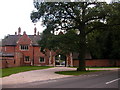
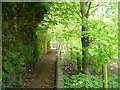
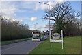
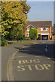
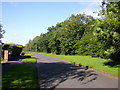
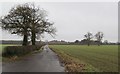
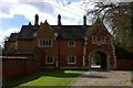
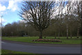
41 photos from this area
Area Information
Key information about the CV22 6JT including its size, population, and administrative classification.
- Area Type
- Postcode
- Area Size
- 1.4 hectares
- Population
- 1555
- Population Density
- 2904 people/km²
House Prices in CV22 6JT
21
Properties
£285,132
Average Sold Price
£96,000
Lowest Price
£610,000
Highest Price
Showing 21 properties
| Address | Type | Beds | Baths | Last Sale Price | Last Sale Date | |
|---|---|---|---|---|---|---|
| 156 Bawnmore Road, Rugby, CV22 6JT | house | - | - | £610,000 | Mar 2021 | |
| 132 Bawnmore Road, Rugby, CV22 6JT | Detached | 4 | 2 | £360,000 | May 2019 | |
| 154 Bawnmore Road, Rugby, CV22 6JT | house | - | - | £280,000 | Oct 2014 | |
| 136 Bawnmore Road, Rugby, CV22 6JT | Detached | 4 | - | £309,950 | Jul 2014 | |
| 138 Bawnmore Road, Rugby, CV22 6JT | house | - | - | £310,000 | Nov 2013 | |
| 152 Bawnmore Road, Rugby, CV22 6JT | house | - | - | £400,000 | Mar 2013 | |
| 150 Bawnmore Road, Rugby, CV22 6JT | house | - | - | £265,000 | Sep 2009 | |
| 144 Bawnmore Road, Rugby, CV22 6JT | Detached | 4 | 2 | £250,000 | Nov 2002 | |
| 148 Bawnmore Road, Rugby, CV22 6JT | Detached | - | - | £133,000 | Jun 1998 | |
| 118 Bawnmore Road, Rugby, CV22 6JT | Detached | - | - | £122,500 | Aug 1996 |
Page 1 of 3
Energy Efficiency in CV22 6JT
Amenities
Schools
| Rank | School | Type | Entry gender | Ages |
|---|
Explore more schools in this area
Go to Schools tabDemographics
Household Size
Two person
most common
Accommodation Type
Houses
most common
Tenure
85
majority
Ethnic Group
White
most common
Religion
N/A
most common
Household Composition
N/A
most common
Age
47
median
Adults (30-64 years)
most common
Household Deprivation
N/A
with no deprivation
NS-SEC
38
in Lower managerial occupations
Explore more demographic insights in this area
Go to Demographics tabPlanning
Planning Constraints
- Flood RiskPremium
- Ramsar Wetland SitesPremium
- Area of Outstanding Natural BeautyPremium
- Protected Nature ReservePremium
- Protected WoodlandPremium