Area Overview for CV22 5AT
Photos of CV22 5AT
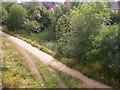
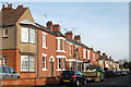
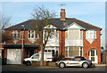
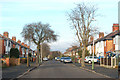
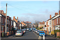
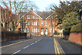
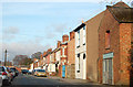
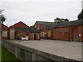
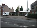
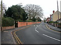
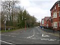
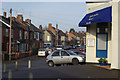
77 photos from this area
Area Information
Key information about the CV22 5AT including its size, population, and administrative classification.
- Area Type
- Postcode
- Area Size
- 1.2 hectares
- Population
- 2415
- Population Density
- 4626 people/km²
House Prices in CV22 5AT
20
Properties
£266,571
Average Sold Price
£90,000
Lowest Price
£530,000
Highest Price
Showing 20 properties
| Address | Type | Beds | Baths | Last Sale Price | Last Sale Date | |
|---|---|---|---|---|---|---|
| 107 Hillmorton Road, Rugby, CV22 5AT | house | - | - | £465,000 | Jun 2021 | |
| 105 Hillmorton Road, Rugby, CV22 5AT | Semi-detached | - | - | £130,000 | Jan 2019 | |
| 103 Hillmorton Road, Rugby, CV22 5AT | Detached | 3 | 2 | £355,000 | Jul 2018 | |
| 111 Hillmorton Road, Rugby, CV22 5AT | house | - | - | £308,000 | Jun 2018 | |
| 127 Hillmorton Road, Rugby, CV22 5AT | house | - | - | £530,000 | Dec 2017 | |
| 129 Hillmorton Road, Rugby, CV22 5AT | Semi-detached | 4 | 1 | £400,000 | Sep 2017 | |
| Mudeford House, 137 Hillmorton Road, Rugby, CV22 5AT | Detached | 4 | 2 | £375,000 | Aug 2014 | |
| 119 Hillmorton Road, Rugby, CV22 5AT | house | - | - | £218,000 | Jul 2009 | |
| 109 Hillmorton Road, Rugby, CV22 5AT | Detached | 4 | 2 | £208,000 | Mar 2007 | |
| 131 Hillmorton Road, Rugby, CV22 5AT | Semi-detached | - | - | £200,000 | Jul 2006 |
Page 1 of 2
Energy Efficiency in CV22 5AT
Amenities
Schools
| Rank | School | Type | Entry gender | Ages |
|---|
Explore more schools in this area
Go to Schools tabDemographics
Household Size
Family (3-5 people)
most common
Accommodation Type
Houses
most common
Tenure
78
majority
Ethnic Group
White
most common
Religion
N/A
most common
Household Composition
N/A
most common
Age
47
median
Adults (30-64 years)
most common
Household Deprivation
N/A
with no deprivation
NS-SEC
43
in Lower managerial occupations
Explore more demographic insights in this area
Go to Demographics tabPlanning
Planning Constraints
- Flood RiskPremium
- Ramsar Wetland SitesPremium
- Area of Outstanding Natural BeautyPremium
- Protected Nature ReservePremium
- Protected WoodlandPremium