Area Overview for CV21 4AU
Photos of CV21 4AU
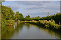
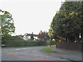
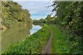
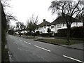
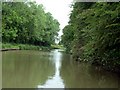
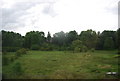
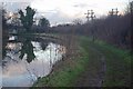
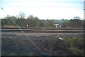
28 photos from this area
Area Information
Key information about the CV21 4AU including its size, population, and administrative classification.
- Area Type
- Postcode
- Area Size
- 5.2 hectares
- Population
- 1107
- Population Density
- 1833 people/km²
House Prices in CV21 4AU
35
Properties
£184,904
Average Sold Price
£45,000
Lowest Price
£389,500
Highest Price
Showing 35 properties
| Address | Type | Beds | Baths | Last Sale Price | Last Sale Date | |
|---|---|---|---|---|---|---|
| 107 Mckinnell Crescent, Rugby, CV21 4AU | house | 2 | 2 | £252,000 | Sep 2025 | |
| 95 Mckinnell Crescent, Rugby, CV21 4AU | Bungalow | 3 | 1 | £389,500 | Mar 2025 | |
| 60 Mckinnell Crescent, Rugby, CV21 4AU | Bungalow | - | - | £218,000 | Oct 2024 | |
| 99 Mckinnell Crescent, Rugby, CV21 4AU | Bungalow | 2 | 1 | £230,000 | Aug 2023 | |
| 48 Mckinnell Crescent, Rugby, CV21 4AU | Semi-detached | 2 | 1 | £235,000 | Oct 2022 | |
| 64 Mckinnell Crescent, Rugby, CV21 4AU | Bungalow | - | - | £205,000 | Sep 2021 | |
| 72 Mckinnell Crescent, Rugby, CV21 4AU | Bungalow | - | - | £210,000 | Mar 2021 | |
| 79 Mckinnell Crescent, Rugby, CV21 4AU | house | - | - | £210,000 | Nov 2020 | |
| 70 Mckinnell Crescent, Rugby, CV21 4AU | Semi-detached | 3 | 1 | £248,000 | Nov 2020 | |
| 52 Mckinnell Crescent, Rugby, CV21 4AU | Semi-detached | - | - | £144,297 | Mar 2019 |
Page 1 of 4
Energy Efficiency in CV21 4AU
Amenities
Schools
| Rank | School | Type | Entry gender | Ages |
|---|
Explore more schools in this area
Go to Schools tabDemographics
Household Size
Two person
most common
Accommodation Type
Houses
most common
Tenure
93
majority
Ethnic Group
White
most common
Religion
N/A
most common
Household Composition
N/A
most common
Age
47
median
Adults (30-64 years)
most common
Household Deprivation
N/A
with no deprivation
NS-SEC
39
in Lower managerial occupations
Explore more demographic insights in this area
Go to Demographics tabPlanning
Planning Constraints
- Flood RiskPremium
- Ramsar Wetland SitesPremium
- Area of Outstanding Natural BeautyPremium
- Protected Nature ReservePremium
- Protected WoodlandPremium