Area Overview for CV21 3UE
Photos of CV21 3UE
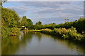
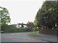
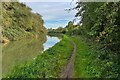
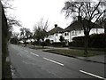
28 photos from this area
Area Information
Key information about the CV21 3UE including its size, population, and administrative classification.
- Area Type
- Postcode
- Area Size
- 4.2 hectares
- Population
- 2109
- Population Density
- 4955 people/km²
House Prices in CV21 3UE
59
Properties
£254,056
Average Sold Price
£59,995
Lowest Price
£643,095
Highest Price
Showing 59 properties
| Address | Type | Beds | Baths | Last Sale Price | Last Sale Date | |
|---|---|---|---|---|---|---|
| 6 Stanley Road, Rugby, CV21 3UE | Semi-detached | 3 | 1 | £395,000 | Nov 2024 | |
| 2 Stanley Road, Rugby, CV21 3UE | house | - | - | £643,095 | Sep 2021 | |
| 17 Stanley Road, Rugby, CV21 3UE | Detached | 4 | 1 | £455,000 | Sep 2021 | |
| 16 Stanley Road, Rugby, CV21 3UE | house | - | - | £385,000 | Aug 2021 | |
| 48 Stanley Road, Rugby, CV21 3UE | house | - | - | £375,000 | Jun 2021 | |
| 37 Stanley Road, Rugby, CV21 3UE | house | - | - | £315,000 | Mar 2021 | |
| 19 Stanley Road, Rugby, CV21 3UE | house | - | - | £325,000 | Jun 2020 | |
| 24 Stanley Road, Rugby, CV21 3UE | house | - | - | £336,750 | May 2020 | |
| 46 Stanley Road, Rugby, CV21 3UE | Detached | 3 | 1 | £305,000 | Apr 2020 | |
| 35 Stanley Road, Rugby, CV21 3UE | house | - | - | £326,500 | Feb 2020 |
Page 1 of 6
Energy Efficiency in CV21 3UE
Amenities
Schools
| Rank | School | Type | Entry gender | Ages |
|---|
Explore more schools in this area
Go to Schools tabDemographics
Household Size
Family (3-5 people)
most common
Accommodation Type
Houses
most common
Tenure
74
majority
Ethnic Group
White
most common
Religion
N/A
most common
Household Composition
N/A
most common
Age
47
median
Adults (30-64 years)
most common
Household Deprivation
N/A
with no deprivation
NS-SEC
33
in Lower managerial occupations
Explore more demographic insights in this area
Go to Demographics tabPlanning
Planning Constraints
- Flood RiskPremium
- Ramsar Wetland SitesPremium
- Area of Outstanding Natural BeautyPremium
- Protected Nature ReservePremium
- Protected WoodlandPremium