Area Overview for CV21 3TP
Photos of CV21 3TP
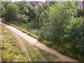
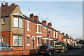
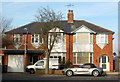
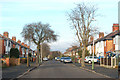
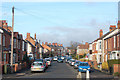
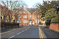
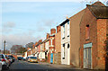
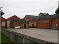
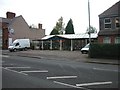
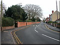
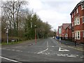
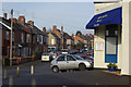
77 photos from this area
Area Information
Key information about the CV21 3TP including its size, population, and administrative classification.
- Area Type
- Postcode
- Area Size
- 3.8 hectares
- Population
- 1107
- Population Density
- 1833 people/km²
House Prices in CV21 3TP
35
Properties
£257,338
Average Sold Price
£105,000
Lowest Price
£476,000
Highest Price
Showing 35 properties
| Address | Type | Beds | Baths | Last Sale Price | Last Sale Date | |
|---|---|---|---|---|---|---|
| 25 Hart Close, Rugby, CV21 3TP | house | 3 | - | £312,000 | Jul 2025 | |
| 23 Hart Close, Rugby, CV21 3TP | Semi-detached | 3 | 1 | £278,000 | Sep 2024 | |
| 24 Hart Close, Rugby, CV21 3TP | Semi-detached | 5 | 2 | £425,000 | Jun 2023 | |
| 9 Hart Close, Rugby, CV21 3TP | Semi-detached | 5 | 3 | £476,000 | Jan 2023 | |
| 6 Hart Close, Rugby, CV21 3TP | house | - | - | £324,580 | Aug 2022 | |
| 13 Hart Close, Rugby, CV21 3TP | Retail | 3 | 1 | £280,000 | Jul 2022 | |
| 4 Hart Close, Rugby, CV21 3TP | Retail | 3 | 1 | £312,000 | Apr 2022 | |
| 31 Hart Close, Rugby, CV21 3TP | house | - | - | £270,000 | Jul 2021 | |
| 26 Hart Close, Rugby, CV21 3TP | Semi-detached | 3 | 1 | £315,000 | Jun 2021 | |
| 18 Hart Close, Rugby, CV21 3TP | house | - | - | £292,500 | Jun 2020 |
Page 1 of 4
Energy Efficiency in CV21 3TP
Amenities
Schools
| Rank | School | Type | Entry gender | Ages |
|---|
Explore more schools in this area
Go to Schools tabDemographics
Household Size
Two person
most common
Accommodation Type
Houses
most common
Tenure
93
majority
Ethnic Group
White
most common
Religion
N/A
most common
Household Composition
N/A
most common
Age
47
median
Adults (30-64 years)
most common
Household Deprivation
N/A
with no deprivation
NS-SEC
39
in Lower managerial occupations
Explore more demographic insights in this area
Go to Demographics tabPlanning
Planning Constraints
- Flood RiskPremium
- Ramsar Wetland SitesPremium
- Area of Outstanding Natural BeautyPremium
- Protected Nature ReservePremium
- Protected WoodlandPremium