Area Overview for CV21 1SL
Photos of CV21 1SL


Area Information
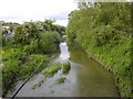
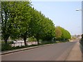
CV21 1SL is a small, residential postcode area nestled in the Rugby Borough Council area of Warwickshire. It forms part of the Newbold and Brownsover Ward, a district with a population of around 1,674, though the postcode itself covers 1,882 residents. Located approximately 1½ miles north-west of Rugby town centre, it sits near the River Avon, blending historic charm with modern convenience. The area includes the suburbs of Newbold-on-Avon and Brownsover, both of which have roots in Saxon and medieval times. Newbold-on-Avon, historically a separate village, was merged into Rugby in 1932, while Brownsover, once a hamlet, is home to notable sites like Brownsover Hall, a Victorian country house linked to jet engine development. Daily life here is shaped by its proximity to Rugby’s amenities, combined with the quiet character of its rural surroundings. The area’s small size means residents often know their neighbours, and the mix of historic buildings, canals, and parks offers a distinct sense of place.
- Area Type
- Postcode
- Area Size
- Not available
- Population
- 1882
- Population Density
- 3849 people/km²
The property market in CV21 1SL is characterised by a 49% home ownership rate, with houses making up the majority of accommodation types. This suggests a focus on owner-occupied properties rather than a rental-dominated market, though the relatively low home ownership figure indicates some reliance on private rentals. The small size of the postcode area means the housing stock is likely limited, with properties concentrated in Newbold-on-Avon and Brownsover. These areas feature historic homes, including 17th- and 18th-century timber-framed buildings, alongside more modern developments. Buyers should consider the limited supply of properties, which may affect competition. The predominance of houses over flats also means the area may appeal to those seeking larger, more private living spaces. Proximity to Rugby’s amenities, combined with a low flood risk, adds to the area’s appeal for those prioritising safety and historical character.
House Prices in CV21 1SL
No properties found in this postcode.
Energy Efficiency in CV21 1SL
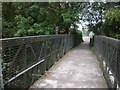
Living in CV21 1SL offers access to a range of amenities within practical reach. Nearby, the town of Rugby hosts major retail outlets such as Tesco, Iceland, and M&S, providing everyday shopping convenience. The Rugby Railway Station, just a short distance away, connects residents to regional transport networks, facilitating travel to nearby cities. For leisure, the area’s proximity to the River Avon and historic sites like Newbold Crown pub and Barley Mow pub adds to its charm. Newbold Quarry Park and Newbold Centenary Park offer green spaces for recreation, while the Oxford Canal and its tunnels provide scenic walks. The presence of listed churches, such as the 15th-century Church of St Botolph, and heritage sites like Brownsover Hall, reflects the area’s rich history. These amenities combine practicality with a sense of tradition, making daily life in CV21 1SL both convenient and characterful.
Amenities
Schools
| Rank | School | Type | Entry gender | Ages |
|---|
Explore more schools in this area
Go to Schools tabDemographics
The population of CV21 1SL is predominantly adults aged 30–64, with a median age of 47. This suggests a mature, stable community, likely with established careers and families. Home ownership rates here are 49%, slightly below the national average, indicating a mix of owner-occupied and rental properties. The majority of accommodation is in houses, reflecting a preference for single-family homes over flats. The predominant ethnic group is White, though specific data on diversity is not provided. The absence of detailed deprivation metrics means it is difficult to assess socioeconomic challenges, but the age profile and housing stock suggest a relatively settled population. For buyers, this demographic profile implies a community with long-term residents, potentially offering a stable and familiar environment.
Household Size
Accommodation Type
Tenure
Ethnic Group
Religion
Household Composition
Age
Household Deprivation
NS-SEC
Explore more demographic insights in this area
Go to Demographics tabPlanning
Planning Constraints
- Flood RiskPremium
- Ramsar Wetland SitesPremium
- Area of Outstanding Natural BeautyPremium
- Protected Nature ReservePremium
- Protected WoodlandPremium