Area Overview for CV21 1RJ
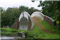
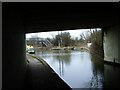
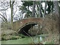
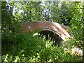
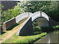
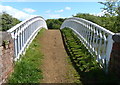
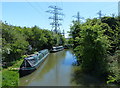
Photos of CV21 1RJ

Area Information
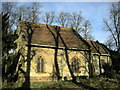
CV21 1RJ lies within the Newbold and Brownsover Ward, a small residential cluster in Rugby Borough Council, Warwickshire. With a population of 1,674 and a density of 1,287 people per square kilometre, this area blends historic charm with modern convenience. Situated approximately 1½ miles north-west of Rugby town centre, it is bordered by the River Avon and lies near postcode CV21 1AA. The area’s character is shaped by its proximity to Rugby, offering access to urban amenities while retaining a village feel. Notable landmarks include the 15th-century Church of St Botolph in Newbold and Brownsover Hall, a Victorian country house now used as a hotel. Daily life here is influenced by its compact size, with residents relying on nearby shops, transport links, and green spaces. The area’s history dates back to Saxon times, with Newbold-on-Avon once a separate parish, and Brownsover linked to 19th-century engineering developments. This mix of heritage and practicality makes CV21 1RJ a distinctive choice for those seeking a balance between tradition and accessibility.
- Area Type
- Postcode
- Area Size
- Not available
- Population
- 1674
- Population Density
- 1287 people/km²
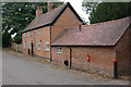
The property market in CV21 1RJ is characterised by a strong emphasis on owner-occupied homes, with 60% of properties owned by residents rather than rented. This suggests a stable, long-term resident base, potentially attracting buyers seeking family homes or investment opportunities. The accommodation type is predominantly houses, which aligns with the area’s historical and architectural heritage, including timber-framed buildings and 18th-century structures. This housing stock may appeal to those prioritising space and traditional design. However, the small size of the area means the market is limited, with fewer options for buyers. Proximity to Rugby adds value, offering access to urban facilities without the density of the town centre. For buyers, this could mean a focus on character properties with potential for renovation, though competition may be fierce due to the area’s desirability.
House Prices in CV21 1RJ
No properties found in this postcode.
Energy Efficiency in CV21 1RJ
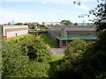
Living in CV21 1RJ offers access to a range of amenities within practical reach. Retail options include M&S Rugby, Iceland Rugby, and Tesco Rugby, providing essential shopping and dining choices. The nearby Rugby Railway Station adds convenience for commuters and travellers, linking the area to regional transport networks. While the data does not specify parks or leisure facilities, the area’s historical context suggests proximity to green spaces, such as Newbold Quarry Park and Newbold Centenary Park, which may be accessible within a short drive. The presence of retail hubs and transport links supports a lifestyle that balances local convenience with broader opportunities. For residents, this means a mix of daily essentials and the ability to connect with Rugby’s urban offerings. The compact nature of the area ensures amenities are not too distant, contributing to a practical, community-focused way of life.
Amenities
Schools
| Rank | School | Type | Entry gender | Ages |
|---|
Explore more schools in this area
Go to Schools tabDemographics
The community in CV21 1RJ is predominantly middle-aged, with a median age of 47 and the most common age range being 30–64 years. This suggests a population skewed towards adults, likely including families and professionals. Home ownership is strong, with 60% of residents owning their homes, and the accommodation type is primarily houses, indicating a focus on family-friendly housing. The predominant ethnic group is White, reflecting the area’s demographic profile. The population density of 1,287 people per square kilometre implies a compact, closely knit community. While no specific data on deprivation is provided, the high home ownership rate and stable age distribution suggest a relatively stable quality of life. However, the absence of detailed diversity metrics means the community’s full composition remains less defined. The area’s residents likely value the combination of residential tranquillity and proximity to Rugby’s amenities.
Household Size
Accommodation Type
Tenure
Ethnic Group
Religion
Household Composition
Age
Household Deprivation
NS-SEC
Explore more demographic insights in this area
Go to Demographics tabPlanning
Planning Constraints
- Flood RiskPremium
- Ramsar Wetland SitesPremium
- Area of Outstanding Natural BeautyPremium
- Protected Nature ReservePremium
- Protected WoodlandPremium