Area Overview for CV2 5GS
Photos of CV2 5GS
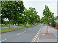
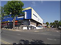
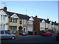
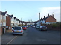
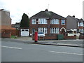
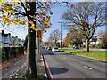
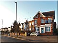
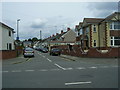


18 photos from this area
Area Information
Key information about the CV2 5GS including its size, population, and administrative classification.
- Area Type
- Postcode
- Area Size
- 1.9 hectares
- Population
- 1688
- Population Density
- 6586 people/km²
House Prices in CV2 5GS
37
Properties
£151,963
Average Sold Price
£50,000
Lowest Price
£378,000
Highest Price
Showing 37 properties
| Address | Type | Beds | Baths | Last Sale Price | Last Sale Date | |
|---|---|---|---|---|---|---|
| 123 Morris Avenue, Coventry, CV2 5GS | Terraced | 3 | 1 | £220,000 | Feb 2025 | |
| 77 Morris Avenue, Coventry, CV2 5GS | Terraced | 3 | 1 | £245,000 | Dec 2024 | |
| 99 Morris Avenue, Coventry, CV2 5GS | house | - | - | £227,000 | Feb 2024 | |
| 95 Morris Avenue, Coventry, CV2 5GS | house | - | - | £238,000 | Sep 2023 | |
| 69 Morris Avenue, Coventry, CV2 5GS | Terraced | 5 | 2 | £378,000 | Mar 2022 | |
| 131 Morris Avenue, Coventry, CV2 5GS | house | - | - | £160,000 | Oct 2019 | |
| 91 Morris Avenue, Coventry, CV2 5GS | house | - | - | £145,000 | Mar 2018 | |
| 137 Morris Avenue, Coventry, CV2 5GS | Terraced | 3 | 1 | £190,000 | Jul 2017 | |
| 121 Morris Avenue, Coventry, CV2 5GS | house | - | - | £260,000 | Sep 2016 | |
| 101 Morris Avenue, Coventry, CV2 5GS | house | - | - | £143,000 | Apr 2016 |
Page 1 of 4
Energy Efficiency in CV2 5GS
Amenities
Schools
| Rank | School | Type | Entry gender | Ages |
|---|
Explore more schools in this area
Go to Schools tabDemographics
Household Size
Family (3-5 people)
most common
Accommodation Type
Houses
most common
Tenure
76
majority
Ethnic Group
White
most common
Religion
N/A
most common
Household Composition
N/A
most common
Age
47
median
Adults (30-64 years)
most common
Household Deprivation
N/A
with no deprivation
NS-SEC
25
in Lower managerial occupations
Explore more demographic insights in this area
Go to Demographics tabPlanning
Planning Constraints
- Flood RiskPremium
- Ramsar Wetland SitesPremium
- Area of Outstanding Natural BeautyPremium
- Protected Nature ReservePremium
- Protected WoodlandPremium