Area Overview for CV2 5EQ
Photos of CV2 5EQ
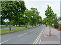
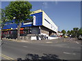
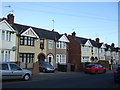
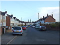
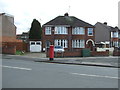
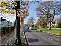
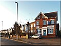
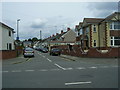

18 photos from this area
Area Information
Key information about the CV2 5EQ including its size, population, and administrative classification.
- Area Type
- Postcode
- Area Size
- 6683 m²
- Population
- 1493
- Population Density
- 7598 people/km²
House Prices in CV2 5EQ
25
Properties
£151,907
Average Sold Price
£56,950
Lowest Price
£245,000
Highest Price
Showing 25 properties
| Address | Type | Beds | Baths | Last Sale Price | Last Sale Date | |
|---|---|---|---|---|---|---|
| 22 Farren Road, Coventry, CV2 5EQ | Terraced | 3 | 1 | £215,000 | Dec 2025 | |
| 20 Farren Road, Coventry, CV2 5EQ | Terraced | 3 | 1 | £202,500 | Dec 2025 | |
| 10 Farren Road, Coventry, CV2 5EQ | Terraced | 3 | 1 | £245,000 | Nov 2023 | |
| 38 Farren Road, Coventry, CV2 5EQ | Terraced | 3 | 2 | £235,000 | Feb 2023 | |
| 36 Farren Road, Coventry, CV2 5EQ | house | - | - | £200,000 | Aug 2021 | |
| 46 Farren Road, Coventry, CV2 5EQ | house | 3 | - | £149,000 | Apr 2015 | |
| 26 Farren Road, Coventry, CV2 5EQ | house | - | - | £129,000 | Jun 2011 | |
| 2B Farren Road, Coventry, CV2 5EQ | Semi-detached | - | - | £142,250 | Feb 2008 | |
| 40 Farren Road, Coventry, CV2 5EQ | Terraced | - | - | £134,000 | Nov 2006 | |
| 2A Farren Road, Coventry, CV2 5EQ | Semi-detached | 3 | 1 | £128,000 | Feb 2006 |
Page 1 of 3
Energy Efficiency in CV2 5EQ
Amenities
Schools
| Rank | School | Type | Entry gender | Ages |
|---|
Explore more schools in this area
Go to Schools tabDemographics
Household Size
Family (3-5 people)
most common
Accommodation Type
Houses
most common
Tenure
75
majority
Ethnic Group
White
most common
Religion
N/A
most common
Household Composition
N/A
most common
Age
47
median
Adults (30-64 years)
most common
Household Deprivation
N/A
with no deprivation
NS-SEC
25
in Lower managerial occupations
Explore more demographic insights in this area
Go to Demographics tabPlanning
Planning Constraints
- Flood RiskPremium
- Ramsar Wetland SitesPremium
- Area of Outstanding Natural BeautyPremium
- Protected Nature ReservePremium
- Protected WoodlandPremium