Area Overview for CV2 5BP
Photos of CV2 5BP
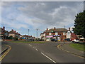
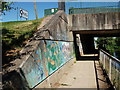
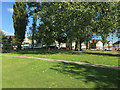

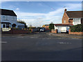
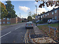
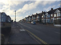
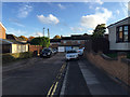
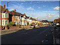
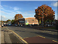


62 photos from this area
Area Information
Key information about the CV2 5BP including its size, population, and administrative classification.
- Area Type
- Postcode
- Area Size
- 8456 m²
- Population
- 1411
- Population Density
- 3926 people/km²
House Prices in CV2 5BP
48
Properties
£125,278
Average Sold Price
£60,000
Lowest Price
£212,000
Highest Price
Showing 48 properties
| Address | Type | Beds | Baths | Last Sale Price | Last Sale Date | |
|---|---|---|---|---|---|---|
| 61 Westmorland Road, Coventry, CV2 5BP | house | - | - | £160,000 | Jul 2025 | |
| 57 Westmorland Road, Coventry, CV2 5BP | Terraced | 3 | 1 | £212,000 | Aug 2024 | |
| 53 Westmorland Road, Coventry, CV2 5BP | Terraced | 3 | 1 | £195,000 | Mar 2024 | |
| 59 Westmorland Road, Coventry, CV2 5BP | Terraced | 3 | 1 | £167,500 | Aug 2022 | |
| 63 Westmorland Road, Coventry, CV2 5BP | Retail | 3 | 1 | £185,500 | Jul 2022 | |
| 67 Westmorland Road, Coventry, CV2 5BP | Terraced | 3 | 1 | £151,500 | Jun 2020 | |
| 89 Westmorland Road, Coventry, CV2 5BP | Flat | 1 | 1 | £100,000 | Feb 2019 | |
| 45 Westmorland Road, Coventry, CV2 5BP | Terraced | 3 | 1 | £142,500 | Jun 2017 | |
| 25 Westmorland Road, Coventry, CV2 5BP | Terraced | 3 | 1 | £133,000 | Mar 2017 | |
| 37 Westmorland Road, Coventry, CV2 5BP | Flat | - | - | £69,000 | Mar 2016 |
Page 1 of 5
Energy Efficiency in CV2 5BP
Amenities
Schools
| Rank | School | Type | Entry gender | Ages |
|---|
Explore more schools in this area
Go to Schools tabDemographics
Household Size
Family (3-5 people)
most common
Accommodation Type
Houses
most common
Tenure
55
majority
Ethnic Group
White
most common
Religion
N/A
most common
Household Composition
N/A
most common
Age
47
median
Adults (30-64 years)
most common
Household Deprivation
N/A
with no deprivation
NS-SEC
30
in Lower managerial occupations
Explore more demographic insights in this area
Go to Demographics tabPlanning
Planning Constraints
- Flood RiskPremium
- Ramsar Wetland SitesPremium
- Area of Outstanding Natural BeautyPremium
- Protected Nature ReservePremium
- Protected WoodlandPremium