Area Overview for CV2 4RP
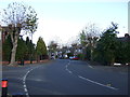
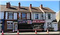
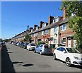
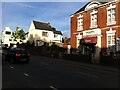
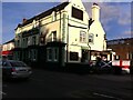
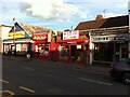
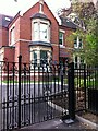
Photos of CV2 4RP
Area Information
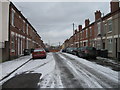
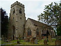
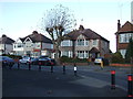
CV2 4RP is a small residential postcode area in Coventry, part of the Wyken and Upper Stoke Character Area. With a population of 1,731, it reflects a suburban settlement rooted in medieval history, where open fields were enclosed in the 17th century and later developed into terraced and semi-detached housing. The area’s compact size and low population density create a quiet, community-focused environment, with homes typically set back from roads and featuring small rear gardens. Residents benefit from proximity to historic sites like the 14th-century Church of St Michael and Grade II-listed Green Farmhouse, blending modern living with heritage. The median age of 47 suggests a mature demographic, with many households likely established in the area for years. Daily life is shaped by local amenities, including schools, rail links, and retail options, while the absence of major planning constraints allows for a straightforward housing market. This postcode is ideal for those seeking a stable, low-maintenance lifestyle with access to both historical and practical resources.
- Area Type
- Postcode
- Area Size
- Not available
- Population
- 1731
- Population Density
- 6689 people/km²
The property market in CV2 4RP is characterised by a 49% home ownership rate, with houses forming the majority of the accommodation stock. This suggests a modest, family-oriented housing stock, likely comprising small terraced and semi-detached homes. The area’s small size means the market is limited in scale, but the presence of established properties indicates a stable demand for long-term residences. With no significant planning constraints or protected land, development is likely to focus on maintaining existing housing rather than large-scale expansion. For buyers, this means a market skewed towards owner-occupied properties, though the lower homeownership rate may reflect a reliance on rental options. The compact nature of the area means proximity to amenities and transport is a key selling point, appealing to those prioritising convenience over property size.
House Prices in CV2 4RP
No properties found in this postcode.
Energy Efficiency in CV2 4RP
The lifestyle in CV2 4RP is shaped by its suburban character and access to essential amenities. Residents can shop at nearby venues like Tesco Ball Hill and Heron Upper, while the Heart of England Co-operative Co provides additional retail options. Rail stations such as Coventry Arena and Canley offer convenient links to nearby towns and cities, supporting both daily commutes and weekend travel. The presence of two airports, though unnamed in operational detail, adds to the area’s connectivity. The suburban layout, with small homes and gardens, fosters a quiet, family-friendly environment. The area’s historical sites, like the Church of St Michael, contribute to a sense of local identity, while the absence of major planning constraints ensures a straightforward, low-maintenance lifestyle.
Amenities
Schools
Residents of CV2 4RP have access to several primary schools, including Stoke Primary School, Stoke Park School and Community Technology College, Stoke Junior School, and Stoke Infant School. Stoke Park School, an academy, holds a ‘good’ Ofsted rating, while the others are rated ‘satisfactory’. The mix of primary schools and an academy provides families with options ranging from traditional state education to potentially more specialised teaching approaches. The concentration of primary schools in the area suggests a strong focus on early education, with proximity to schools likely a key factor for families. The absence of secondary schools nearby means students may need to travel to neighbouring areas, though the presence of multiple primary options ensures local access to education for younger children.
| Rank | School | Type | Entry gender | Ages |
|---|
Explore more schools in this area
Go to Schools tabDemographics
The population of CV2 4RP is 1,731, with a median age of 47. The most common age range is adults aged 30–64, indicating a community of settled families and professionals. Home ownership stands at 49%, with houses being the predominant accommodation type. This suggests a mix of owner-occupied and rental properties, though the relatively low homeownership rate may reflect a reliance on private rentals or shared living arrangements. The predominant ethnic group is White, though specific data on diversity or deprivation is not provided. The age profile implies a stable, middle-aged population, likely with children in local schools and a focus on long-term residency. The absence of data on deprivation means the area’s quality of life can only be inferred from its amenities and safety metrics, which suggest a moderate to acceptable standard.
Household Size
Accommodation Type
Tenure
Ethnic Group
Religion
Household Composition
Age
Household Deprivation
NS-SEC
Explore more demographic insights in this area
Go to Demographics tabPlanning
Planning Constraints
- Flood RiskPremium
- Ramsar Wetland SitesPremium
- Area of Outstanding Natural BeautyPremium
- Protected Nature ReservePremium
- Protected WoodlandPremium