Area Overview for CV2 4RJ
Photos of CV2 4RJ


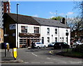
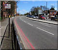
98 photos from this area
Area Information
Key information about the CV2 4RJ including its size, population, and administrative classification.
- Area Type
- Postcode
- Area Size
- 3316 m²
- Population
- 1922
- Population Density
- 6709 people/km²
House Prices in CV2 4RJ
25
Properties
£81,507
Average Sold Price
£34,000
Lowest Price
£121,000
Highest Price
Showing 25 properties
| Address | Type | Beds | Baths | Last Sale Price | Last Sale Date | |
|---|---|---|---|---|---|---|
| 19 Brunel Close, Coventry, CV2 4RJ | Maisonette | 1 | - | £100,500 | May 2024 | |
| 8 Brunel Close, Coventry, CV2 4RJ | house | 2 | 1 | £121,000 | Aug 2023 | |
| 24 Brunel Close, Coventry, CV2 4RJ | Flat | 2 | 1 | £112,500 | May 2022 | |
| 4 Brunel Close, Coventry, CV2 4RJ | Flat | - | - | £100,000 | Sep 2021 | |
| 6 Brunel Close, Coventry, CV2 4RJ | Flat | 2 | 1 | £94,000 | Mar 2020 | |
| 25 Brunel Close, Coventry, CV2 4RJ | Flat | - | - | £102,500 | Jun 2019 | |
| 26 Brunel Close, Coventry, CV2 4RJ | Flat | - | - | £94,000 | May 2018 | |
| 5 Brunel Close, Coventry, CV2 4RJ | Flat | 2 | 1 | £93,000 | Oct 2017 | |
| 12 Brunel Close, Coventry, CV2 4RJ | Flat | 1 | 1 | £70,000 | Apr 2017 | |
| 14 Brunel Close, Coventry, CV2 4RJ | Maisonette | 1 | 1 | £75,000 | Jul 2016 |
Page 1 of 3
Energy Efficiency in CV2 4RJ
Amenities
Schools
| Rank | School | Type | Entry gender | Ages |
|---|
Explore more schools in this area
Go to Schools tabDemographics
Household Size
One person
most common
Accommodation Type
Houses
most common
Tenure
11
majority
Ethnic Group
White
most common
Religion
N/A
most common
Household Composition
N/A
most common
Age
22
median
Young Adults (15-29 years)
most common
Household Deprivation
N/A
with no deprivation
NS-SEC
5
in Lower managerial occupations
Explore more demographic insights in this area
Go to Demographics tabPlanning
Planning Constraints
- Flood RiskPremium
- Ramsar Wetland SitesPremium
- Area of Outstanding Natural BeautyPremium
- Protected Nature ReservePremium
- Protected WoodlandPremium