Area Overview for CV2 4LL
Photos of CV2 4LL
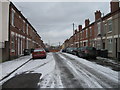
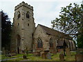
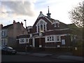
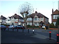
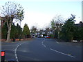
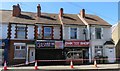
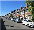
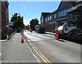
50 photos from this area
Area Information
Key information about the CV2 4LL including its size, population, and administrative classification.
- Area Type
- Postcode
- Area Size
- 1.3 hectares
- Population
- 1731
- Population Density
- 6689 people/km²
House Prices in CV2 4LL
63
Properties
£82,962
Average Sold Price
£25,000
Lowest Price
£183,000
Highest Price
Showing 63 properties
| Address | Type | Beds | Baths | Last Sale Price | Last Sale Date | |
|---|---|---|---|---|---|---|
| 43 Dawes Close, Coventry, CV2 4LL | Flat | - | - | £90,000 | Dec 2024 | |
| 20 Dawes Close, Coventry, CV2 4LL | Terraced | 2 | 1 | £183,000 | Aug 2024 | |
| 5 Dawes Close, Coventry, CV2 4LL | Terraced | 2 | 1 | £163,000 | Mar 2024 | |
| 18 Dawes Close, Coventry, CV2 4LL | house | - | - | £140,000 | Feb 2021 | |
| 7 Dawes Close, Coventry, CV2 4LL | Terraced | 2 | 1 | £145,000 | Aug 2020 | |
| 37 Dawes Close, Coventry, CV2 4LL | Flat | 1 | 1 | £86,500 | Nov 2019 | |
| 19 Dawes Close, Coventry, CV2 4LL | Flat | - | - | £90,000 | Jul 2019 | |
| 69 Dawes Close, Coventry, CV2 4LL | Semi-detached | 2 | 1 | £141,000 | Nov 2018 | |
| 87 Dawes Close, Coventry, CV2 4LL | Terraced | 2 | 1 | £130,500 | Oct 2018 | |
| 10 Dawes Close, Coventry, CV2 4LL | Terraced | 2 | 1 | £130,000 | Feb 2018 |
Page 1 of 7
Energy Efficiency in CV2 4LL
Amenities
Schools
| Rank | School | Type | Entry gender | Ages |
|---|
Explore more schools in this area
Go to Schools tabDemographics
Household Size
Family (3-5 people)
most common
Accommodation Type
Houses
most common
Tenure
49
majority
Ethnic Group
White
most common
Religion
N/A
most common
Household Composition
N/A
most common
Age
47
median
Adults (30-64 years)
most common
Household Deprivation
N/A
with no deprivation
NS-SEC
20
in Lower managerial occupations
Explore more demographic insights in this area
Go to Demographics tabPlanning
Planning Constraints
- Flood RiskPremium
- Ramsar Wetland SitesPremium
- Area of Outstanding Natural BeautyPremium
- Protected Nature ReservePremium
- Protected WoodlandPremium