Area Overview for CV2 4FB
Photos of CV2 4FB
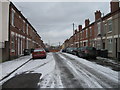
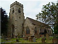
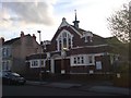
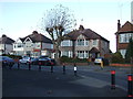
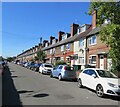

50 photos from this area
Area Information
Key information about the CV2 4FB including its size, population, and administrative classification.
- Area Type
- Postcode
- Area Size
- 4403 m²
- Population
- 2031
- Population Density
- 8955 people/km²
House Prices in CV2 4FB
33
Properties
£135,443
Average Sold Price
£44,500
Lowest Price
£315,000
Highest Price
Showing 33 properties
| Address | Type | Beds | Baths | Last Sale Price | Last Sale Date | |
|---|---|---|---|---|---|---|
| 64 Dean Street, Coventry, CV2 4FB | Terraced | 2 | 1 | £168,000 | Aug 2024 | |
| 30 Dean Street, Coventry, CV2 4FB | Terraced | 5 | 5 | £315,000 | Jul 2024 | |
| 48 Dean Street, Coventry, CV2 4FB | house | 1 | 1 | £160,000 | Apr 2023 | |
| 58 Dean Street, Coventry, CV2 4FB | Terraced | 3 | 3 | £165,000 | Nov 2022 | |
| 56 Dean Street, Coventry, CV2 4FB | house | 1 | 1 | £145,000 | Sep 2022 | |
| 26 Dean Street, Coventry, CV2 4FB | Terraced | 3 | 1 | £157,100 | Oct 2021 | |
| 50 Dean Street, Coventry, CV2 4FB | house | 2 | - | £123,000 | Aug 2021 | |
| 62 Dean Street, Coventry, CV2 4FB | house | 1 | 1 | £138,000 | Jul 2021 | |
| 28 Dean Street, Coventry, CV2 4FB | Terraced | 5 | 5 | £285,000 | Mar 2021 | |
| 60 Dean Street, Coventry, CV2 4FB | house | 5 | 5 | £136,750 | Nov 2020 |
Page 1 of 4
Energy Efficiency in CV2 4FB
Amenities
Schools
| Rank | School | Type | Entry gender | Ages |
|---|
Explore more schools in this area
Go to Schools tabDemographics
Household Size
Family (3-5 people)
most common
Accommodation Type
Houses
most common
Tenure
20
majority
Ethnic Group
White
most common
Religion
N/A
most common
Household Composition
N/A
most common
Age
22
median
Adults (30-64 years)
most common
Household Deprivation
N/A
with no deprivation
NS-SEC
13
in Lower managerial occupations
Explore more demographic insights in this area
Go to Demographics tabPlanning
Planning Constraints
- Flood RiskPremium
- Ramsar Wetland SitesPremium
- Area of Outstanding Natural BeautyPremium
- Protected Nature ReservePremium
- Protected WoodlandPremium