Area Overview for CV2 4BP
Photos of CV2 4BP
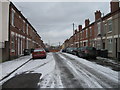
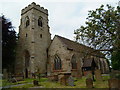
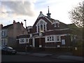
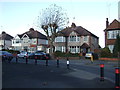
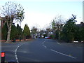
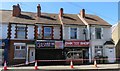
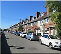
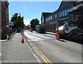
50 photos from this area
Area Information
Key information about the CV2 4BP including its size, population, and administrative classification.
- Area Type
- Postcode
- Area Size
- 4460 m²
- Population
- 1703
- Population Density
- 6780 people/km²
House Prices in CV2 4BP
14
Properties
£123,120
Average Sold Price
£39,000
Lowest Price
£206,500
Highest Price
Showing 14 properties
| Address | Type | Beds | Baths | Last Sale Price | Last Sale Date | |
|---|---|---|---|---|---|---|
| 224 Walsgrave Road, Coventry, CV2 4BP | house | 4 | - | £206,500 | Oct 2020 | |
| 228 Walsgrave Road, Coventry, CV2 4BP | house | 1 | 1 | £192,000 | Oct 2017 | |
| 210 Walsgrave Road, Coventry, CV2 4BP | Terraced | 3 | 1 | £160,000 | Dec 2016 | |
| 216 Walsgrave Road, Coventry, CV2 4BP | Terraced | 3 | 1 | £154,500 | Mar 2016 | |
| 234 Walsgrave Road, Coventry, CV2 4BP | Terraced | 3 | 1 | £135,000 | Sep 2015 | |
| 212 Walsgrave Road, Coventry, CV2 4BP | Terraced | 3 | 1 | £110,000 | Sep 2004 | |
| 222 Walsgrave Road, Coventry, CV2 4BP | Terraced | - | - | £129,500 | Apr 2004 | |
| 226 Walsgrave Road, Coventry, CV2 4BP | Terraced | - | - | £59,950 | Jul 2000 | |
| 236 Walsgrave Road, Coventry, CV2 4BP | Terraced | 3 | 1 | £39,000 | Feb 1999 | |
| 230 Walsgrave Road, Coventry, CV2 4BP | Terraced | - | - | £44,750 | Feb 1995 |
Page 1 of 2
Energy Efficiency in CV2 4BP
Amenities
Schools
| Rank | School | Type | Entry gender | Ages |
|---|
Explore more schools in this area
Go to Schools tabDemographics
Household Size
Family (3-5 people)
most common
Accommodation Type
Houses
most common
Tenure
52
majority
Ethnic Group
White
most common
Religion
N/A
most common
Household Composition
N/A
most common
Age
47
median
Adults (30-64 years)
most common
Household Deprivation
N/A
with no deprivation
NS-SEC
24
in Lower managerial occupations
Explore more demographic insights in this area
Go to Demographics tabPlanning
Planning Constraints
- Flood RiskPremium
- Ramsar Wetland SitesPremium
- Area of Outstanding Natural BeautyPremium
- Protected Nature ReservePremium
- Protected WoodlandPremium