Area Overview for CV2 3PY
Photos of CV2 3PY


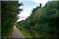
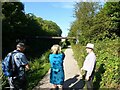
![A stroll along the Coventry Canal to Hawkesbury Junction [19] in CV2 3PY](https://images.propbar.co.uk/images/geograph/71/21/7121157_120.jpg)
Area Information
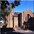
CV2 3PY is a small residential cluster in Coventry’s Wyken and Upper Stoke Character Area, home to around 2,041 people. The area reflects a blend of medieval heritage and suburban development, with terraced and semi-detached houses set back from roads, many featuring rear gardens. Its origins trace to 17th-century enclosed fields and 19th-century industrial growth, including munitions workers’ housing and former factories like the Peel-Conner Telephone works. Today, it is a quiet, low-density neighbourhood with a mature population. Residents benefit from proximity to Coventry’s rail network, including Canley and Bedworth stations, and nearby retail hubs like Tesco Ball Hill and Aldi Edgwick. Broadband connectivity is excellent, with a score of 100, supporting remote work or leisure. The area’s character is defined by its historical roots, including the 14th-century Church of St Michael and remnants of medieval settlements, offering a sense of continuity in a modern setting.
- Area Type
- Postcode
- Area Size
- Not available
- Population
- 2041
- Population Density
- 9533 people/km²
The property market in CV2 3PY is characterised by a 45% home ownership rate, indicating that the majority of residents rent. The area’s housing stock consists primarily of houses, with a focus on small terraced and semi-detached properties. These homes typically feature small rear gardens and setbacks from roads, reflecting the suburban layout. Given the low population density and limited housing supply, the market is likely to be competitive for buyers, with opportunities extending to nearby areas. The predominance of owner-occupied and rental houses suggests a balance between long-term residents and tenants. For buyers, the small scale of the area means exploring adjacent postcode clusters may be necessary to find a wider range of properties. The historical development of the area, including 19th-century housing estates, has created a mix of older and newer homes, offering varied options for different budgets.
House Prices in CV2 3PY
No properties found in this postcode.
Energy Efficiency in CV2 3PY
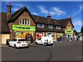
Living in CV2 3PY offers access to a range of local amenities within practical reach. Retail options include five shops, such as the Heart of England Co-operative, Aldi Edgwick, and Tesco Ball Hill, catering to daily needs. The area’s rail links provide easy access to Coventry’s cultural and commercial hubs, with stations like Canley and Bedworth facilitating commutes. While the data does not mention parks or leisure facilities, the historical context of the area—such as the 14th-century Church of St Michael—adds to its charm. The suburban layout, with homes set back from roads, allows for a quieter lifestyle, though the proximity to retail and transport ensures convenience. The mix of modern retail and historical sites creates a balanced environment for residents seeking both practicality and a touch of heritage.
Amenities
Schools
| Rank | School | Type | Entry gender | Ages |
|---|
Explore more schools in this area
Go to Schools tabDemographics
The population of CV2 3PY has a median age of 47, with the majority aged between 30 and 64. This suggests a community of established adults, likely focused on family life or retirement. Home ownership stands at 45%, meaning over half of residents rent, which may reflect the area’s suburban nature and limited housing stock. The predominant accommodation type is houses, with a lack of high-rise or apartment blocks. The predominant ethnic group is White, though specific data on diversity is not provided. The age profile indicates a stable, low-turnover population, which can contribute to a cohesive community. However, the relatively high proportion of renters may impact long-term investment in property. The absence of detailed deprivation data means the quality of life remains unquantified, but the age range and housing type suggest a mix of working professionals and families.
Household Size
Accommodation Type
Tenure
Ethnic Group
Religion
Household Composition
Age
Household Deprivation
NS-SEC
Explore more demographic insights in this area
Go to Demographics tabPlanning
Planning Constraints
- Flood RiskPremium
- Ramsar Wetland SitesPremium
- Area of Outstanding Natural BeautyPremium
- Protected Nature ReservePremium
- Protected WoodlandPremium