Area Overview for CV2 3GY
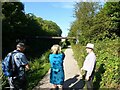
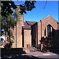
Photos of CV2 3GY
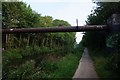
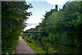
![A stroll along the Coventry Canal to Hawkesbury Junction [19] in CV2 3GY](https://images.propbar.co.uk/images/geograph/71/21/7121157_120.jpg)
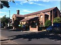
31 photos from this area
Area Information
Key information about the CV2 3GY including its size, population, and administrative classification.
- Area Type
- Postcode
- Area Size
- 1.1 hectares
- Population
- 1627
- Population Density
- 5223 people/km²
House Prices in CV2 3GY
40
Properties
£115,753
Average Sold Price
£22,000
Lowest Price
£250,000
Highest Price
Showing 40 properties
| Address | Type | Beds | Baths | Last Sale Price | Last Sale Date | |
|---|---|---|---|---|---|---|
| 17 Alliance Way, Coventry, CV2 3GY | Terraced | 4 | 2 | £250,000 | Jul 2024 | |
| 41 Alliance Way, Coventry, CV2 3GY | house | - | - | £155,000 | Oct 2021 | |
| 5 Alliance Way, Coventry, CV2 3GY | Terraced | 3 | 1 | £170,000 | Oct 2021 | |
| 37 Alliance Way, Coventry, CV2 3GY | house | - | - | £153,000 | Mar 2020 | |
| 47 Alliance Way, Coventry, CV2 3GY | Terraced | 3 | 1 | £131,800 | Jun 2018 | |
| 15 Alliance Way, Coventry, CV2 3GY | Terraced | 3 | 1 | £137,000 | Feb 2017 | |
| 33 Alliance Way, Coventry, CV2 3GY | Terraced | 2 | - | £75,000 | Jan 2013 | |
| 29 Alliance Way, Coventry, CV2 3GY | house | 2 | - | £95,000 | Jul 2012 | |
| 59 Alliance Way, Coventry, CV2 3GY | Semi-detached | 3 | - | £112,000 | Aug 2011 | |
| 21 Alliance Way, Coventry, CV2 3GY | house | 3 | - | £119,000 | Jun 2011 |
Page 1 of 4
Energy Efficiency in CV2 3GY
Amenities
Schools
| Rank | School | Type | Entry gender | Ages |
|---|
Explore more schools in this area
Go to Schools tabDemographics
Household Size
Two person
most common
Accommodation Type
Houses
most common
Tenure
43
majority
Ethnic Group
White
most common
Religion
N/A
most common
Household Composition
N/A
most common
Age
47
median
Adults (30-64 years)
most common
Household Deprivation
N/A
with no deprivation
NS-SEC
15
in Lower managerial occupations
Explore more demographic insights in this area
Go to Demographics tabPlanning
Planning Constraints
- Flood RiskPremium
- Ramsar Wetland SitesPremium
- Area of Outstanding Natural BeautyPremium
- Protected Nature ReservePremium
- Protected WoodlandPremium