Area Overview for CV2 1ZW
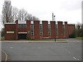
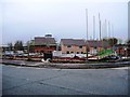
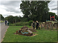
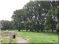
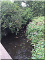
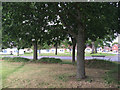
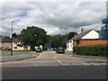
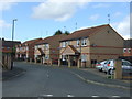
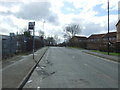
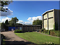
Photos of CV2 1ZW


Area Information
CV2 1ZW is a small residential postcode area in England, home to 1,732 people. It is a compact cluster of properties, likely centred around a mix of housing stock and local amenities. The area’s population suggests a close-knit community, with a median age of 47 and a majority of residents aged between 30 and 64. This indicates a mature, stable population, possibly with families and professionals. The area is characterised by a low home ownership rate of 29%, suggesting a higher proportion of rental properties. The predominant accommodation type is houses, which may reflect a mix of semi-detached and detached homes. While specific historical or cultural details are not provided, the area benefits from proximity to schools, rail networks, and retail hubs. Digital connectivity is strong, with a broadband score of 97 and mobile coverage of 85, ensuring reliable internet access for both work and leisure. However, the area’s small size means its immediate surroundings, rather than the postcode itself, may hold more extensive amenities. For those considering living in CV2 1ZW, the blend of practical infrastructure and modest community scale could appeal to those seeking a balanced lifestyle.
- Area Type
- Postcode
- Area Size
- Not available
- Population
- 1732
- Population Density
- 7993 people/km²
The property market in CV2 1ZW is defined by a low home ownership rate of 29%, indicating that the majority of properties are rented rather than owner-occupied. The predominant accommodation type is houses, which may include a range of styles such as semi-detached or detached homes. This suggests a housing stock that is not heavily reliant on flats or apartments, which is uncommon in urban areas. The small population and limited postcode area imply that the number of available properties is restricted, making the local market potentially competitive for buyers. For those considering purchasing, the focus would likely shift to nearby areas with more extensive housing options. The low home ownership rate may also reflect broader regional trends, such as a preference for rental properties in certain demographics. Given the area’s size, buyers may need to look beyond CV2 1ZW to find a wider selection of homes, particularly if seeking specific property types or larger spaces.
House Prices in CV2 1ZW
No properties found in this postcode.
Energy Efficiency in CV2 1ZW
Residents of CV2 1ZW have access to a range of local amenities within practical reach. Retail options include Farmfoods Foleshill, Co-op Woodway, and Morrisons Daily, providing essential shopping and grocery services. The area’s rail network connects to stations such as Coventry Arena, Bedworth, and Canley, facilitating easy travel to nearby towns and cities. For air travel, Coventry Airport is within proximity, though its significance as a major airport is unclear from the data. The combination of retail outlets and transport links ensures convenience for daily life, from purchasing household goods to commuting or traveling. While the area’s small size may limit the diversity of amenities, the presence of multiple shops and rail stations suggests a functional, community-focused lifestyle. The availability of these services supports both practical needs and a degree of independence, allowing residents to manage their routines without long commutes or extended travel.
Amenities
Schools
The nearest school to CV2 1ZW is St Patrick’s Catholic Primary School, which serves the local community. The school is listed twice in the data, with one entry noting an Ofsted rating of ‘good’. This indicates that the school provides a quality primary education, which is essential for families with young children. As a primary school, it caters to students aged 4 to 11, covering the early years of formal education. The presence of a single primary school in the area suggests that secondary education options may be located further afield, requiring families to consider commuting arrangements. The ‘good’ Ofsted rating highlights that the school meets or exceeds national standards in teaching quality, student outcomes, and overall performance. For families prioritising education, the availability of a well-rated primary school is a significant advantage, though further research would be needed to assess secondary school options in the surrounding area.
| Rank | School | Type | Entry gender | Ages |
|---|
Explore more schools in this area
Go to Schools tabDemographics
The population of CV2 1ZW is 1,732, with a median age of 47. The majority of residents fall within the 30-64 age range, suggesting a community of established adults, many of whom may be in their prime working years. Home ownership is relatively low at 29%, implying that a significant portion of the population resides in rental properties. The accommodation type is predominantly houses, which may include semi-detached or detached homes, rather than flats or apartments. The predominant ethnic group is White, reflecting the broader demographic trends in the region. While no specific data on deprivation or diversity beyond ethnicity is provided, the age profile and home ownership rate suggest a community that is neither heavily young nor elderly, with a mix of household types. The low home ownership rate may indicate a reliance on private rentals, which could influence the local property market and community dynamics. The area’s demographics paint a picture of stability, with a focus on adult residents and a moderate level of property tenure diversity.
Household Size
Accommodation Type
Tenure
Ethnic Group
Religion
Household Composition
Age
Household Deprivation
NS-SEC
Explore more demographic insights in this area
Go to Demographics tabPlanning
Planning Constraints
- Flood RiskPremium
- Ramsar Wetland SitesPremium
- Area of Outstanding Natural BeautyPremium
- Protected Nature ReservePremium
- Protected WoodlandPremium