Area Overview for CV2 1QB
Photos of CV2 1QB
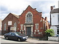

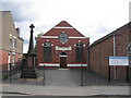
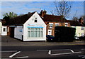
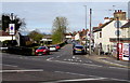
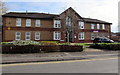
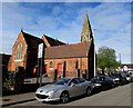
77 photos from this area
Area Information
Key information about the CV2 1QB including its size, population, and administrative classification.
- Area Type
- Postcode
- Area Size
- 1.2 hectares
- Population
- 1975
- Population Density
- 5072 people/km²
House Prices in CV2 1QB
53
Properties
£126,420
Average Sold Price
£26,500
Lowest Price
£245,000
Highest Price
Showing 53 properties
| Address | Type | Beds | Baths | Last Sale Price | Last Sale Date | |
|---|---|---|---|---|---|---|
| 99 Foxford Crescent, Coventry, CV2 1QB | Terraced | 1 | 1 | £200,000 | May 2025 | |
| 87A Foxford Crescent, Coventry, CV2 1QB | Bungalow | 2 | 1 | £245,000 | Mar 2024 | |
| 29 Foxford Crescent, Coventry, CV2 1QB | Terraced | 3 | 1 | £183,500 | Feb 2024 | |
| 41 Foxford Crescent, Coventry, CV2 1QB | house | - | - | £195,000 | Jan 2024 | |
| 91 Foxford Crescent, Coventry, CV2 1QB | house | - | - | £192,000 | Sep 2021 | |
| 39 Foxford Crescent, Coventry, CV2 1QB | house | - | - | £175,000 | May 2021 | |
| 1 Foxford Crescent, Coventry, CV2 1QB | Terraced | 3 | 2 | £168,000 | Jan 2020 | |
| 93 Foxford Crescent, Coventry, CV2 1QB | house | - | - | £145,000 | Oct 2019 | |
| 103 Foxford Crescent, Coventry, CV2 1QB | Semi-detached | 4 | 1 | £154,500 | Jan 2019 | |
| 49 Foxford Crescent, Coventry, CV2 1QB | house | - | - | £135,000 | May 2017 |
Page 1 of 6
Energy Efficiency in CV2 1QB
Amenities
Schools
| Rank | School | Type | Entry gender | Ages |
|---|
Explore more schools in this area
Go to Schools tabDemographics
Household Size
One person
most common
Accommodation Type
Houses
most common
Tenure
66
majority
Ethnic Group
White
most common
Religion
N/A
most common
Household Composition
N/A
most common
Age
47
median
Adults (30-64 years)
most common
Household Deprivation
N/A
with no deprivation
NS-SEC
22
in Lower managerial occupations
Explore more demographic insights in this area
Go to Demographics tabPlanning
Planning Constraints
- Flood RiskPremium
- Ramsar Wetland SitesPremium
- Area of Outstanding Natural BeautyPremium
- Protected Nature ReservePremium
- Protected WoodlandPremium