Area Overview for CV12 9EA
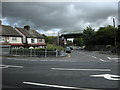
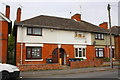
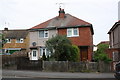
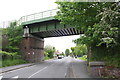
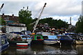
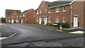
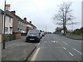
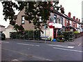
Photos of CV12 9EA


Area Information
CV12 9EA is a small residential postcode in the suburban village of Exhall, part of the Coventry and Bedworth urban area in Warwickshire. Covering just 6.2 hectares, this compact area is home to 1,295 residents, making it one of the most densely populated places in England, with 20,935 people per square kilometre. The community is centred around a mix of traditional housing, with a median age of 47 and a majority of residents aged 30–64. Living here means navigating a tight-knit, high-density environment where daily life is shaped by proximity to local amenities. The area’s small size means residents are close to key services, though the limited space can create a sense of constraint. Exhall’s location within the Nuneaton and Bedworth Borough Council area places it near larger urban hubs, offering access to regional infrastructure while retaining a village-like character. For those seeking a compact, mature community with easy access to nearby towns, CV12 9EA presents a distinct blend of suburban convenience and residential density.
- Area Type
- Postcode
- Area Size
- 6.2 hectares
- Population
- 1295
- Population Density
- 3139 people/km²
The property market in CV12 9EA is characterised by a 55% home ownership rate, with houses forming the majority of accommodation. This indicates a mix of owner-occupied and rental properties, though the small area size suggests limited housing stock. Given the high population density, properties are likely to be smaller or multi-occupancy units, reflecting the need to accommodate a large number of residents within a confined space. For buyers, the area’s compact nature means competition for available homes, particularly as demand may spill into nearby suburbs. The predominance of houses over flats or apartments suggests a preference for traditional housing, though the lack of specific data on property types beyond “houses” limits deeper analysis. Buyers should consider proximity to transport links and amenities, as the area’s small size may necessitate looking beyond CV12 9EA for larger properties or more space.
House Prices in CV12 9EA
Showing 3 properties
Energy Efficiency in CV12 9EA
Daily life in CV12 9EA is shaped by its proximity to retail and transport hubs, though the area itself offers limited leisure or recreational spaces. The nearby retail outlets—Tesco, Aldi, and Iceland—provide essential shopping, while the five rail stations connect residents to broader networks. However, the data does not mention parks, restaurants, or cultural amenities, suggesting that leisure activities may require travel to nearby towns. The high population density may mean limited private outdoor space, though the presence of rail links could offset this by enabling access to larger urban areas for recreation. For those prioritising convenience, the compact layout ensures services are within practical reach, but the lack of detailed information on local parks or community facilities means residents may need to look beyond the postcode for a full range of lifestyle options.
Amenities
Schools
Residents of CV12 9EA have access to a range of primary and nursery schools, including Bedworth Early Years Centre and Nursery, Henry Bellairs CofE Junior School, Hob Lane CofE Infant School, Nicholas Chamberlaine Technology College, and St Michael’s Church of England Primary School. These institutions cater to young children and provide a mix of faith-based and secular education options. The presence of multiple primary schools suggests a well-established local education network, though the data does not include Ofsted ratings or performance metrics. Families with young children may benefit from the proximity of these schools, reducing commuting times. However, the absence of secondary schools in the immediate area could necessitate travel to nearby towns for further education. The diversity of school types offers flexibility for parents seeking specific educational approaches, though the quality of individual institutions remains unverified by the provided data.
| Rank | School | Type | Entry gender | Ages |
|---|
Explore more schools in this area
Go to Schools tabDemographics
The population of CV12 9EA is 1,295, with a median age of 47, reflecting a mature demographic skewed towards adults aged 30–64. Home ownership stands at 55%, with houses being the predominant accommodation type. This suggests a stable, long-term resident base, though the relatively low ownership rate indicates a significant portion of the population may rent. The predominant ethnic group is White, which aligns with broader trends in the West Midlands region. The high population density—20,935 people per square kilometre—raises questions about living space per household, though the data does not specify average household sizes. For quality of life, this density could mean limited private outdoor space but proximity to services. The community’s age profile suggests a mix of working-age individuals and retirees, potentially supporting a range of local amenities and services tailored to different life stages.
Household Size
Accommodation Type
Tenure
Ethnic Group
Religion
Household Composition
Age
Household Deprivation
NS-SEC
Explore more demographic insights in this area
Go to Demographics tabPlanning
Planning Constraints
- Flood RiskPremium
- Ramsar Wetland SitesPremium
- Area of Outstanding Natural BeautyPremium
- Protected Nature ReservePremium
- Protected WoodlandPremium