Area Overview for CV11 6PH
Photos of CV11 6PH
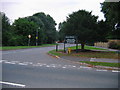

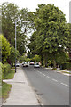
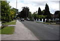
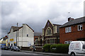
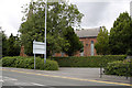
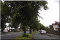
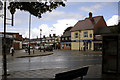
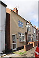
57 photos from this area
Area Information
Key information about the CV11 6PH including its size, population, and administrative classification.
- Area Type
- Postcode
- Area Size
- 3.1 hectares
- Population
- 1330
- Population Density
- 1378 people/km²
House Prices in CV11 6PH
37
Properties
£348,758
Average Sold Price
£67,500
Lowest Price
£665,000
Highest Price
Showing 37 properties
| Address | Type | Beds | Baths | Last Sale Price | Last Sale Date | |
|---|---|---|---|---|---|---|
| 82 Lutterworth Road, Nuneaton, CV11 6PH | Detached | 4 | 2 | £501,000 | Mar 2025 | |
| 64A Lutterworth Road, Nuneaton, CV11 6PH | house | - | - | £435,000 | Oct 2023 | |
| 78 Lutterworth Road, Nuneaton, CV11 6PH | Detached | 4 | 3 | £375,000 | Feb 2023 | |
| 110A Lutterworth Road, Nuneaton, CV11 6PH | house | 5 | 2 | £399,000 | Oct 2022 | |
| 98 Lutterworth Road, Nuneaton, CV11 6PH | house | - | - | £535,000 | Jun 2021 | |
| 98A Lutterworth Road, Nuneaton, CV11 6PH | Detached | 4 | 3 | £575,000 | Jun 2021 | |
| 84 Lutterworth Road, Nuneaton, CV11 6PH | Bungalow | - | - | £301,000 | May 2021 | |
| 118 Lutterworth Road, Nuneaton, CV11 6PH | Detached | 4 | 2 | £490,000 | May 2021 | |
| 74 Lutterworth Road, Nuneaton, CV11 6PH | Detached | 5 | 4 | £550,000 | Apr 2020 | |
| 86 Lutterworth Road, Nuneaton, CV11 6PH | Bungalow | 4 | 2 | £334,000 | Mar 2020 |
Page 1 of 4
Energy Efficiency in CV11 6PH
Amenities
Schools
| Rank | School | Type | Entry gender | Ages |
|---|
Explore more schools in this area
Go to Schools tabDemographics
Household Size
Two person
most common
Accommodation Type
Houses
most common
Tenure
86
majority
Ethnic Group
White
most common
Religion
N/A
most common
Household Composition
N/A
most common
Age
47
median
Adults (30-64 years)
most common
Household Deprivation
N/A
with no deprivation
NS-SEC
38
in Lower managerial occupations
Explore more demographic insights in this area
Go to Demographics tabPlanning
Planning Constraints
- Flood RiskPremium
- Ramsar Wetland SitesPremium
- Area of Outstanding Natural BeautyPremium
- Protected Nature ReservePremium
- Protected WoodlandPremium