Area Overview for CV11 6FW
Photos of CV11 6FW
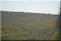
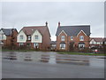
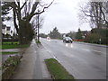
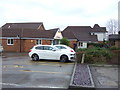
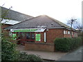
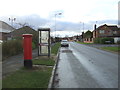
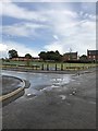
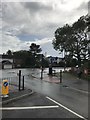
40 photos from this area
Area Information
Key information about the CV11 6FW including its size, population, and administrative classification.
- Area Type
- Postcode
- Area Size
- 2.2 hectares
- Population
- 1349
- Population Density
- 3844 people/km²
House Prices in CV11 6FW
37
Properties
£243,807
Average Sold Price
£105,000
Lowest Price
£398,500
Highest Price
Showing 37 properties
| Address | Type | Beds | Baths | Last Sale Price | Last Sale Date | |
|---|---|---|---|---|---|---|
| 38 Penzance Way, Nuneaton, CV11 6FW | Detached | 5 | 2 | £398,500 | Aug 2025 | |
| 7 Penzance Way, Nuneaton, CV11 6FW | Detached | 3 | 2 | £372,000 | Mar 2025 | |
| 21 Penzance Way, Nuneaton, CV11 6FW | house | - | - | £335,000 | Dec 2021 | |
| 12 Penzance Way, Nuneaton, CV11 6FW | house | - | - | £375,630 | Sep 2021 | |
| 3 Penzance Way, Nuneaton, CV11 6FW | Detached | 3 | 2 | £265,000 | Nov 2020 | |
| 2 Penzance Way, Nuneaton, CV11 6FW | Detached | 5 | 1 | £295,000 | Jul 2019 | |
| 17 Penzance Way, Nuneaton, CV11 6FW | Detached | 5 | - | £267,000 | Jan 2018 | |
| 18 Penzance Way, Nuneaton, CV11 6FW | Detached | 3 | - | £183,500 | Apr 2014 | |
| 19 Penzance Way, Nuneaton, CV11 6FW | Detached | - | - | £240,000 | Nov 2012 | |
| 8 Penzance Way, Nuneaton, CV11 6FW | Detached | 5 | - | £240,000 | Jun 2012 |
Page 1 of 4
Energy Efficiency in CV11 6FW
Amenities
Schools
| Rank | School | Type | Entry gender | Ages |
|---|
Explore more schools in this area
Go to Schools tabDemographics
Household Size
Family (3-5 people)
most common
Accommodation Type
Houses
most common
Tenure
93
majority
Ethnic Group
White
most common
Religion
N/A
most common
Household Composition
N/A
most common
Age
47
median
Adults (30-64 years)
most common
Household Deprivation
N/A
with no deprivation
NS-SEC
42
in Lower managerial occupations
Explore more demographic insights in this area
Go to Demographics tabPlanning
Planning Constraints
- Flood RiskPremium
- Ramsar Wetland SitesPremium
- Area of Outstanding Natural BeautyPremium
- Protected Nature ReservePremium
- Protected WoodlandPremium