Area Overview for CV11 5XA
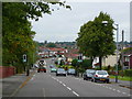
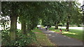
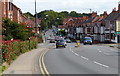
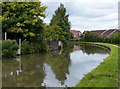
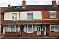
Photos of CV11 5XA


Area Information
CV11 5XA is a small, residential postcode area in the borough of Nuneaton and Bedworth, part of St. Mary’s Ward, which holds historical significance as Nuneaton’s first middle-class suburb from the late 19th and early 20th centuries. With a population of 1,991, the area is compact yet rich in heritage, centred around Manor Court Road and the Abbey Conservation Area. This includes the Priory of St. Mary, founded in the 12th century, and St. Mary’s Church, built between 1876 and 1891. Daily life here is shaped by its proximity to retail hubs like Lidl Central, Iceland Nuneaton, and Sainsburys Nuneaton, as well as rail connections to Nuneaton Railway Station and Shenton Railway Station. The area’s low crime risk score of 74 and no flood or environmental constraints make it a practical choice for those seeking a stable, historically grounded community. Its blend of traditional housing and modern amenities offers a quiet, accessible lifestyle within the West Midlands.
- Area Type
- Postcode
- Area Size
- Not available
- Population
- 1991
- Population Density
- 11664 people/km²
The property market in CV11 5XA is characterised by a predominance of houses, with 49% of properties owner-occupied. This suggests a mix of private residences and rental properties, though the exact proportion of rentals is not specified. The area’s small size means housing stock is likely limited to traditional homes, reflecting its historical development as a suburban cluster. For buyers, this implies a focus on individual properties rather than high-density housing. The low crime risk and lack of environmental constraints make it an attractive option for those seeking stability. However, the relatively low home ownership rate may indicate limited availability of properties for sale, with a stronger rental market. Buyers should consider the area’s compact nature and proximity to Nuneaton’s amenities when evaluating its appeal.
House Prices in CV11 5XA
No properties found in this postcode.
Energy Efficiency in CV11 5XA
Living in CV11 5XA offers access to a range of amenities within practical reach. Retail options include major supermarkets like Lidl Central, Iceland Nuneaton, and Sainsburys Nuneaton, ensuring convenience for daily shopping. The area’s proximity to rail stations, such as Nuneaton and Shenton, provides easy access to the town’s cultural and commercial hubs. Historically, the Abbey Conservation Area adds character, encompassing St. Mary’s Church, the former Nuneaton Cottage Hospital, and Manor Court Road. These features blend heritage with modern living, offering a quiet, community-focused environment. Parks and recreational spaces, such as the recreation ground near the priory, provide opportunities for leisure. The balance of historical sites, retail, and transport options creates a lifestyle that is both practical and rooted in local tradition.
Amenities
Schools
| Rank | School | Type | Entry gender | Ages |
|---|
Explore more schools in this area
Go to Schools tabDemographics
The population of CV11 5XA has a median age of 47, with the majority of residents aged between 30 and 64 years. This suggests a mature, established community, likely with a mix of long-term residents and families. Home ownership stands at 49%, indicating that nearly half of properties are rented, which may reflect a balance between owner-occupied and rental housing. The predominant accommodation type is houses, aligning with the area’s historical development as a suburban zone. The primary ethnic group is White, though specific diversity statistics are not provided. The age profile and home ownership rate suggest a stable, low-turnover community, with a focus on family-oriented living. The absence of deprivation data means the area’s quality of life is not explicitly tied to socioeconomic factors, but the low crime rate and proximity to services imply a functional, well-served environment.
Household Size
Accommodation Type
Tenure
Ethnic Group
Religion
Household Composition
Age
Household Deprivation
NS-SEC
Explore more demographic insights in this area
Go to Demographics tabPlanning
Planning Constraints
- Flood RiskPremium
- Ramsar Wetland SitesPremium
- Area of Outstanding Natural BeautyPremium
- Protected Nature ReservePremium
- Protected WoodlandPremium