Area Overview for CV11 4XP
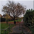
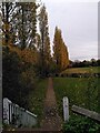
Photos of CV11 4XP


Area Information
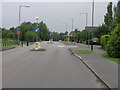
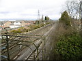
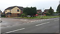
CV11 4XP is a small residential postcode area in Warwickshire, part of the Attleborough Ward within Nuneaton and Bedworth Borough Council. With a population of 1,508, it reflects a compact, suburban settlement adjacent to Nuneaton. The area’s history dates back to before 1150, with roots in medieval landownership and local industry such as stone quarrying, which shaped its landscape. Today, it is a quiet, low-density neighbourhood characterised by houses rather than flats, offering a mix of traditional and modern living. Residents benefit from proximity to nearby towns like Nuneaton and Bedworth, which provide commercial and cultural amenities. The area’s compact size means daily life is centred around local amenities, community spaces, and easy access to rail networks. Its historic character, combined with practical modern infrastructure, makes it appealing to those seeking a balanced lifestyle with connections to both rural and urban environments.
- Area Type
- Postcode
- Area Size
- Not available
- Population
- 1508
- Population Density
- 2095 people/km²
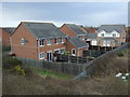
The property market in CV11 4XP is dominated by owner-occupied homes, with 69% of residents owning their properties. The accommodation type is predominantly houses, which is typical of suburban areas with lower density. This suggests a market that caters to families and individuals seeking stable, long-term housing rather than rental properties. The small size of the area means the housing stock is limited, and buyers should consider proximity to nearby towns like Nuneaton for additional options. The focus on houses implies larger living spaces compared to flats, which may appeal to those prioritising space and privacy. For buyers, the area’s compact nature means property choices are concentrated locally, requiring careful evaluation of specific listings.
House Prices in CV11 4XP
No properties found in this postcode.
Energy Efficiency in CV11 4XP
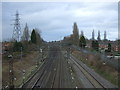
The lifestyle in CV11 4XP is shaped by its proximity to local amenities and nearby towns. Within reach are five retail venues, including Spar, Asda Stoneycroft, and the Heart of England Co-operative Co, offering everyday shopping needs. The rail network provides access to Nuneaton and Bedworth, which host larger retail centres, dining options, and leisure facilities. While the area itself is small, its connection to surrounding towns ensures residents can access a broader range of services. The presence of historic sites like Attleborough Hall and the legacy of the former stone quarry add character to the community. This blend of practical convenience and local heritage supports a lifestyle that balances simplicity with accessibility.
Amenities
Schools
Residents of CV11 4XP have access to two primary schools within practical reach: Whitestone Infant School and Chetwynd Junior School. Both institutions hold an Ofsted rating of ‘good’, indicating a reliable standard of education for younger children. The presence of two primary schools suggests a well-established educational infrastructure for families with young children. While no secondary schools are listed, the proximity to Nuneaton and Bedworth likely provides additional options. The mix of school types supports a seamless transition from early education to further schooling, though parents may need to consider travel times for secondary education.
| Rank | School | Type | Entry gender | Ages |
|---|
Explore more schools in this area
Go to Schools tabDemographics
The population of CV11 4XP is 1,508, with a median age of 47, indicating a mature community. The majority of residents fall within the 30-64 age range, suggesting a stable demographic profile with a strong presence of working-age adults. Home ownership is high at 69%, reflecting a community of long-term residents rather than transient renters. The predominant accommodation type is houses, aligning with the area’s suburban character. The predominant ethnic group is White, though specific data on diversity is not provided. The age profile and ownership rates suggest a settled population, likely with established careers and family ties. This demographic structure implies a focus on community continuity, with amenities and services tailored to the needs of adults and families.
Household Size
Accommodation Type
Tenure
Ethnic Group
Religion
Household Composition
Age
Household Deprivation
NS-SEC
Explore more demographic insights in this area
Go to Demographics tabPlanning
Planning Constraints
- Flood RiskPremium
- Ramsar Wetland SitesPremium
- Area of Outstanding Natural BeautyPremium
- Protected Nature ReservePremium
- Protected WoodlandPremium