Area Overview for CV11 4XG
Photos of CV11 4XG
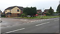
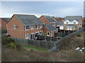
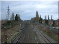
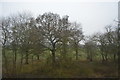
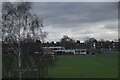
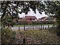
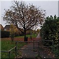
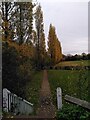
29 photos from this area
Area Information
Key information about the CV11 4XG including its size, population, and administrative classification.
- Area Type
- Postcode
- Area Size
- 3902 m²
- Population
- 1659
- Population Density
- 6216 people/km²
House Prices in CV11 4XG
13
Properties
£156,050
Average Sold Price
£84,950
Lowest Price
£273,000
Highest Price
Showing 13 properties
| Address | Type | Beds | Baths | Last Sale Price | Last Sale Date | |
|---|---|---|---|---|---|---|
| 3 Ashridge Close, Nuneaton, CV11 4XG | Detached | 3 | 2 | £245,000 | Aug 2024 | |
| 11 Ashridge Close, Nuneaton, CV11 4XG | Detached | - | - | £273,000 | Apr 2020 | |
| 13 Ashridge Close, Nuneaton, CV11 4XG | house | - | - | £248,000 | Apr 2018 | |
| 12 Ashridge Close, Nuneaton, CV11 4XG | house | - | - | £192,000 | Mar 2013 | |
| 2 Ashridge Close, Nuneaton, CV11 4XG | house | - | - | £158,000 | Jul 2012 | |
| 1 Ashridge Close, Nuneaton, CV11 4XG | house | - | - | £155,000 | Dec 2011 | |
| 10 Ashridge Close, Nuneaton, CV11 4XG | Detached | - | - | £228,000 | Jul 2006 | |
| 5 Ashridge Close, Nuneaton, CV11 4XG | Detached | - | - | £84,950 | Sep 1999 | |
| 4 Ashridge Close, Nuneaton, CV11 4XG | house | - | - | £87,250 | Jan 1998 | |
| 9 Ashridge Close, Nuneaton, CV11 4XG | Detached | - | - | £92,750 | Nov 1997 |
Page 1 of 2
Energy Efficiency in CV11 4XG
Amenities
Schools
| Rank | School | Type | Entry gender | Ages |
|---|
Explore more schools in this area
Go to Schools tabDemographics
Household Size
Family (3-5 people)
most common
Accommodation Type
Houses
most common
Tenure
74
majority
Ethnic Group
White
most common
Religion
N/A
most common
Household Composition
N/A
most common
Age
47
median
Adults (30-64 years)
most common
Household Deprivation
N/A
with no deprivation
NS-SEC
40
in Lower managerial occupations
Explore more demographic insights in this area
Go to Demographics tabPlanning
Planning Constraints
- Flood RiskPremium
- Ramsar Wetland SitesPremium
- Area of Outstanding Natural BeautyPremium
- Protected Nature ReservePremium
- Protected WoodlandPremium