Area Overview for CV11 4WW
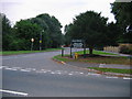
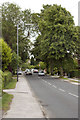
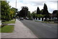
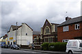
Photos of CV11 4WW


Area Information
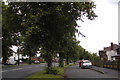
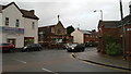
CV11 4WW is a small, tightly knit residential postcode area in Warwickshire, centred around the historic village of Attleborough. With a population of 1,584, it reflects the character of a suburban settlement adjacent to Nuneaton, blending ancient heritage with modern living. The area’s roots trace back to before 1150, when it was part of a medieval estate, and today it retains a quiet, community-focused atmosphere. Residents benefit from proximity to nearby towns like Nuneaton and Bedworth, offering access to services and transport links while maintaining a distinct local identity. The area includes historic sites such as Attleborough Hall, built in 1809, and remnants of a medieval stone quarry that once shaped the region’s architecture. Despite its small size, CV11 4WW is well-connected, with railway stations within practical reach and a mix of retail and leisure options nearby. This postcode is ideal for those seeking a balance between rural tranquillity and urban convenience, with a population skewed towards middle-aged adults and a strong emphasis on homeownership.
- Area Type
- Postcode
- Area Size
- Not available
- Population
- 1584
- Population Density
- 4126 people/km²
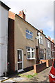
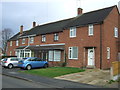
The property market in CV11 4WW is dominated by owner-occupied homes, with 66% of residents owning their properties. This suggests a stable market with a focus on long-term residency rather than short-term rentals. The predominance of houses indicates a preference for larger, family-friendly properties, which may appeal to those seeking space and privacy. Given the small size of the postcode area, the housing stock is likely limited, meaning buyers may need to consider nearby suburbs for additional options. The high home ownership rate also implies that the area is not heavily reliant on rental demand, which could affect property price trends. For buyers, this means a market where properties are likely to be well-maintained and reflect the needs of established households. However, the limited number of properties within the postcode itself may require a broader search in adjacent areas for more choices.
House Prices in CV11 4WW
No properties found in this postcode.
Energy Efficiency in CV11 4WW
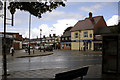
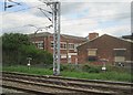
Residents of CV11 4WW have access to a modest selection of amenities within practical reach. The area includes five retail outlets, such as Heart of England Co-operative Co and Spar, providing basic shopping needs. These local stores cater to everyday essentials, reducing the need for long journeys to larger centres. The presence of five railway stations, including Bermuda Park and Nuneaton, offers convenient access to public transport, connecting residents to broader regional services. While the area lacks large supermarkets or entertainment venues, the nearby towns of Nuneaton and Bedworth likely compensate with more extensive options. The combination of local shops and rail links creates a lifestyle that balances self-sufficiency with the ability to access urban amenities. This setup suits those who value a quiet, community-oriented environment but still require reliable access to transport and retail.
Amenities
Schools
The nearest school to CV11 4WW is Leyland School, a special school catering to students with specific educational needs. No other schools are listed in the data, meaning families with children may need to look beyond the immediate area for primary or secondary education. The presence of a special school highlights the area’s accessibility for those requiring tailored support but does not indicate the availability of mainstream schooling. Parents seeking a range of educational options may find it necessary to consider nearby towns like Nuneaton or Bedworth, which likely have more comprehensive school networks. This limitation underscores the importance of proximity to larger centres for families prioritising diverse educational opportunities.
| Rank | School | Type | Entry gender | Ages |
|---|
Explore more schools in this area
Go to Schools tabDemographics
The population of CV11 4WW is 1,584, with a median age of 47, indicating a community predominantly composed of adults aged 30–64. Home ownership stands at 66%, reflecting a stable, long-term resident base. The area is characterised by a predominance of houses, suggesting a focus on family homes and established properties. The predominant ethnic group is White, aligning with broader regional demographics. The age profile suggests a mature population, which may influence local services and amenities. While no specific deprivation data is provided, the high home ownership rate and median age imply a relatively stable economic environment. This demographic profile positions CV11 4WW as a place where residents are likely to have established careers and family ties, contributing to a cohesive community feel. The absence of detailed diversity metrics means the area’s social composition remains largely defined by its primary ethnic group.
Household Size
Accommodation Type
Tenure
Ethnic Group
Religion
Household Composition
Age
Household Deprivation
NS-SEC
Explore more demographic insights in this area
Go to Demographics tabPlanning
Planning Constraints
- Flood RiskPremium
- Ramsar Wetland SitesPremium
- Area of Outstanding Natural BeautyPremium
- Protected Nature ReservePremium
- Protected WoodlandPremium