Area Overview for CV10 9PG
Photos of CV10 9PG
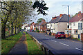
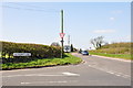
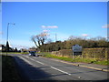
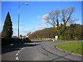
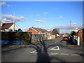
19 photos from this area
Area Information
Key information about the CV10 9PG including its size, population, and administrative classification.
- Area Type
- Postcode
- Area Size
- 6.4 hectares
- Population
- 1614
- Population Density
- 290 people/km²
House Prices in CV10 9PG
26
Properties
£189,666
Average Sold Price
£55,000
Lowest Price
£382,500
Highest Price
Showing 26 properties
| Address | Type | Beds | Baths | Last Sale Price | Last Sale Date | |
|---|---|---|---|---|---|---|
| 170 Birmingham Road, Ansley, CV10 9PG | Detached | 2 | 1 | £279,000 | Oct 2024 | |
| 271 Birmingham Road, Ansley, CV10 9PG | Detached | 3 | 1 | £382,500 | Oct 2024 | |
| 261 Birmingham Road, Ansley, CV10 9PG | Detached | 3 | 1 | £300,000 | May 2023 | |
| 263 Birmingham Road, Ansley, CV10 9PG | house | - | - | £285,000 | Jan 2023 | |
| 186 Birmingham Road, Ansley, CV10 9PG | house | - | - | £300,000 | Sep 2022 | |
| 277 Birmingham Road, Ansley, CV10 9PG | house | - | - | £140,000 | Jul 2019 | |
| 281 Birmingham Road, Ansley, CV10 9PG | house | - | - | £220,000 | Aug 2018 | |
| 275 Birmingham Road, Ansley, CV10 9PG | house | 4 | 4 | £145,000 | Dec 2013 | |
| 273 Birmingham Road, Ansley, CV10 9PG | house | - | - | £185,000 | Nov 2013 | |
| 172 Birmingham Road, Ansley, CV10 9PG | Semi-detached | - | - | £132,950 | Jul 2007 |
Page 1 of 3
Energy Efficiency in CV10 9PG
Amenities
Schools
| Rank | School | Type | Entry gender | Ages |
|---|
Explore more schools in this area
Go to Schools tabDemographics
Household Size
Two person
most common
Accommodation Type
Houses
most common
Tenure
63
majority
Ethnic Group
White
most common
Religion
N/A
most common
Household Composition
N/A
most common
Age
47
median
Adults (30-64 years)
most common
Household Deprivation
N/A
with no deprivation
NS-SEC
26
in Lower managerial occupations
Explore more demographic insights in this area
Go to Demographics tabPlanning
Planning Constraints
- Flood RiskPremium
- Ramsar Wetland SitesPremium
- Area of Outstanding Natural BeautyPremium
- Protected Nature ReservePremium
- Protected WoodlandPremium