Area Overview for CV10 8HJ
Photos of CV10 8HJ
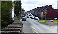
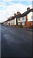
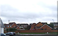
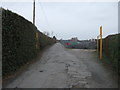
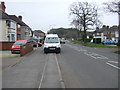
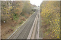
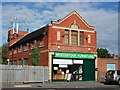
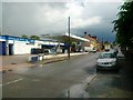
19 photos from this area
Area Information
Key information about the CV10 8HJ including its size, population, and administrative classification.
- Area Type
- Postcode
- Area Size
- 5553 m²
- Population
- 1468
- Population Density
- 4443 people/km²
House Prices in CV10 8HJ
21
Properties
£109,104
Average Sold Price
£39,950
Lowest Price
£210,000
Highest Price
Showing 21 properties
| Address | Type | Beds | Baths | Last Sale Price | Last Sale Date | |
|---|---|---|---|---|---|---|
| 259 Westbury Road, Nuneaton, CV10 8HJ | Bungalow | 2 | 1 | £210,000 | Nov 2023 | |
| 240 Westbury Road, Nuneaton, CV10 8HJ | Terraced | 3 | 1 | £162,000 | Jun 2023 | |
| 250 Westbury Road, Nuneaton, CV10 8HJ | Terraced | 3 | 1 | £139,000 | Sep 2021 | |
| 238 Westbury Road, Nuneaton, CV10 8HJ | Terraced | 3 | - | £147,500 | Aug 2021 | |
| 230 Westbury Road, Nuneaton, CV10 8HJ | house | - | - | £130,000 | Jul 2021 | |
| 249 Westbury Road, Nuneaton, CV10 8HJ | house | - | - | £85,000 | Jul 2021 | |
| 236 Westbury Road, Nuneaton, CV10 8HJ | house | - | - | £125,000 | Mar 2021 | |
| 255 Westbury Road, Nuneaton, CV10 8HJ | Terraced | 2 | 2 | £113,000 | Jul 2019 | |
| 234 Westbury Road, Nuneaton, CV10 8HJ | house | - | - | £96,000 | Jan 2018 | |
| 257 Westbury Road, Nuneaton, CV10 8HJ | Terraced | 3 | 1 | £90,000 | Sep 2015 |
Page 1 of 3
Energy Efficiency in CV10 8HJ
Amenities
Schools
| Rank | School | Type | Entry gender | Ages |
|---|
Explore more schools in this area
Go to Schools tabDemographics
Household Size
Two person
most common
Accommodation Type
Houses
most common
Tenure
66
majority
Ethnic Group
White
most common
Religion
N/A
most common
Household Composition
N/A
most common
Age
47
median
Adults (30-64 years)
most common
Household Deprivation
N/A
with no deprivation
NS-SEC
20
in Lower managerial occupations
Explore more demographic insights in this area
Go to Demographics tabPlanning
Planning Constraints
- Flood RiskPremium
- Ramsar Wetland SitesPremium
- Area of Outstanding Natural BeautyPremium
- Protected Nature ReservePremium
- Protected WoodlandPremium