Area Overview for CV10 7SH
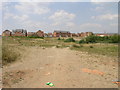
Photos of CV10 7SH


Area Information
CV10 7SH is a small residential postcode area in England, home to 1,852 people spread across 173 people per square kilometre. This compact cluster lies within the historic Arbury district, a place with ancient roots. Archaeological evidence suggests the area has been inhabited for thousands of years, with Iron Age settlements and Roman-era finds recorded in local historical research. The modern development of Arbury includes council housing established in the latter half of the 20th century, blending historical land designations like Arbury Meadows with contemporary living. Residents here are predominantly adults aged 30–64, with a median age of 47. The community is largely owner-occupied, with 63% of homes in private hands. Daily life in CV10 7SH balances proximity to amenities with a quiet, residential character. The area’s small size means neighbours are close, and local landmarks like Bermuda Park Railway Station and Nuneaton Academy are within practical reach. For those seeking a mix of history and modern convenience, CV10 7SH offers a distinct blend of stability and accessibility.
- Area Type
- Postcode
- Area Size
- Not available
- Population
- 1852
- Population Density
- 173 people/km²
The property market in CV10 7SH is characterised by a high rate of home ownership, with 63% of properties in private hands. This suggests a stable, long-term resident base rather than a transient rental market. The accommodation type is predominantly houses, which aligns with the area’s low-density, residential nature. For buyers, this means the housing stock is likely to be family-friendly, with larger properties suited to households with children. The small size of the postcode area means the immediate surroundings are critical for property seekers. Nearby areas may offer more variety, but CV10 7SH itself is focused on established housing. The lack of high-rise or multi-unit developments indicates a quiet, suburban feel. Buyers should consider the proximity to schools and transport when evaluating properties, as these are key factors in the area’s appeal.
House Prices in CV10 7SH
No properties found in this postcode.
Energy Efficiency in CV10 7SH
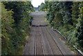
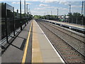
The lifestyle in CV10 7SH is shaped by its proximity to essential amenities. Residents can access retail options like Tesco Nuneaton, Spar, and Tesco Bedworth, offering everyday shopping convenience. Rail connectivity is strong, with five stations nearby, including Bermuda Park and Nuneaton, facilitating travel to surrounding areas. While the data does not mention parks or leisure facilities, the presence of schools and retail hubs suggests a focus on practical living. The area’s small size means amenities are closely clustered, reducing the need for long commutes. For families, the combination of schools and transport options creates a balanced environment. The character of daily life here is defined by accessibility and simplicity, with a quiet residential atmosphere complemented by nearby urban conveniences.
Amenities
Schools
Residents of CV10 7SH have access to a range of educational institutions, including Alderman Smith School and Sports College, a primary school, and Nuneaton Academy, an academy. The Midland Studio College Nuneaton offers secondary education, providing a comprehensive pathway from early years to higher learning. The presence of both primary and secondary schools within the area ensures families have options for their children’s education without long commutes. The mix of school types, including an academy, suggests a focus on varied teaching approaches and resources. For parents, this diversity can be advantageous, allowing them to choose between traditional and alternative educational models. The specific Ofsted ratings for these schools are not provided, but their inclusion in the area’s amenities indicates a commitment to education. Families seeking a well-rounded schooling environment will find CV10 7SH’s schools a key asset.
| Rank | School | Type | Entry gender | Ages |
|---|
Explore more schools in this area
Go to Schools tabDemographics
The population of CV10 7SH is 1,852, with a median age of 47. This suggests a mature community, with the majority of residents aged 30–64. Home ownership is strong here, with 63% of households owning their properties. The accommodation type is predominantly houses, indicating a low-density, family-oriented housing stock. The predominant ethnic group is White, reflecting the area’s demographic composition. While specific data on deprivation is not provided, the age profile and home ownership rate suggest a stable, established community. The presence of schools like Alderman Smith School and Nuneaton Academy indicates a focus on family living. The age range of 30–64 also implies a population with established careers and long-term residency, contributing to a sense of continuity. However, the absence of detailed diversity metrics means the full scope of the community’s social makeup remains partially unexplored.
Household Size
Accommodation Type
Tenure
Ethnic Group
Religion
Household Composition
Age
Household Deprivation
NS-SEC
Explore more demographic insights in this area
Go to Demographics tabPlanning
Planning Constraints
- Flood RiskPremium
- Ramsar Wetland SitesPremium
- Area of Outstanding Natural BeautyPremium
- Protected Nature ReservePremium
- Protected WoodlandPremium