Area Overview for CV10 7GB
Photos of CV10 7GB

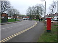
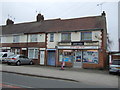
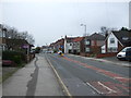
48 photos from this area
Area Information
Key information about the CV10 7GB including its size, population, and administrative classification.
- Area Type
- Postcode
- Area Size
- 9922 m²
- Population
- 2819
- Population Density
- 3415 people/km²
House Prices in CV10 7GB
24
Properties
£227,937
Average Sold Price
£107,500
Lowest Price
£370,000
Highest Price
Showing 24 properties
| Address | Type | Beds | Baths | Last Sale Price | Last Sale Date | |
|---|---|---|---|---|---|---|
| 21 Okeford Way, Nuneaton, CV10 7GB | Detached | 4 | 2 | £342,500 | Feb 2025 | |
| 12 Okeford Way, Nuneaton, CV10 7GB | house | 4 | 3 | £370,000 | Jul 2022 | |
| 13 Okeford Way, Nuneaton, CV10 7GB | house | - | - | £302,000 | Dec 2021 | |
| 10 Okeford Way, Nuneaton, CV10 7GB | house | - | - | £290,000 | Feb 2021 | |
| 23 Okeford Way, Nuneaton, CV10 7GB | Detached | 4 | 2 | £280,000 | Aug 2020 | |
| 9 Okeford Way, Nuneaton, CV10 7GB | house | - | - | £275,000 | Nov 2019 | |
| 15 Okeford Way, Nuneaton, CV10 7GB | Detached | 4 | - | £295,000 | Oct 2017 | |
| 4 Okeford Way, Nuneaton, CV10 7GB | house | - | - | £258,500 | Aug 2017 | |
| 17 Okeford Way, Nuneaton, CV10 7GB | house | 4 | 1 | £247,000 | Aug 2016 | |
| 11 Okeford Way, Nuneaton, CV10 7GB | Detached | 4 | 1 | £247,000 | Jul 2016 |
Page 1 of 3
Energy Efficiency in CV10 7GB
Amenities
Schools
| Rank | School | Type | Entry gender | Ages |
|---|
Explore more schools in this area
Go to Schools tabDemographics
Household Size
Family (3-5 people)
most common
Accommodation Type
Houses
most common
Tenure
70
majority
Ethnic Group
White
most common
Religion
N/A
most common
Household Composition
N/A
most common
Age
47
median
Adults (30-64 years)
most common
Household Deprivation
N/A
with no deprivation
NS-SEC
30
in Lower managerial occupations
Explore more demographic insights in this area
Go to Demographics tabPlanning
Planning Constraints
- Flood RiskPremium
- Ramsar Wetland SitesPremium
- Area of Outstanding Natural BeautyPremium
- Protected Nature ReservePremium
- Protected WoodlandPremium