Area Overview for CV10 0DY
Photos of CV10 0DY
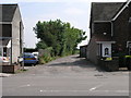
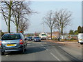
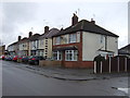
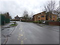
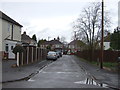
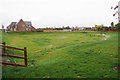
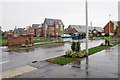
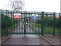
13 photos from this area
Area Information
Key information about the CV10 0DY including its size, population, and administrative classification.
- Area Type
- Postcode
- Area Size
- 1.9 hectares
- Population
- 1562
- Population Density
- 2953 people/km²
House Prices in CV10 0DY
34
Properties
£163,854
Average Sold Price
£55,000
Lowest Price
£267,000
Highest Price
Showing 34 properties
| Address | Type | Beds | Baths | Last Sale Price | Last Sale Date | |
|---|---|---|---|---|---|---|
| 83 Glenfield Avenue, Nuneaton, CV10 0DY | Semi-detached | 3 | 2 | £267,000 | Sep 2024 | |
| 92 Glenfield Avenue, Nuneaton, CV10 0DY | Detached | 3 | 1 | £230,000 | Nov 2023 | |
| 90 Glenfield Avenue, Nuneaton, CV10 0DY | house | - | - | £225,000 | Mar 2023 | |
| 68 Glenfield Avenue, Nuneaton, CV10 0DY | house | - | - | £225,000 | Nov 2021 | |
| 70 Glenfield Avenue, Nuneaton, CV10 0DY | house | - | - | £222,500 | Sep 2021 | |
| 86 Glenfield Avenue, Nuneaton, CV10 0DY | house | - | - | £220,000 | Dec 2020 | |
| 117 Glenfield Avenue, Nuneaton, CV10 0DY | house | - | - | £138,000 | Nov 2020 | |
| 113 Glenfield Avenue, Nuneaton, CV10 0DY | Semi-detached | 2 | 1 | £179,000 | Sep 2020 | |
| 85 Glenfield Avenue, Nuneaton, CV10 0DY | Semi-detached | 2 | 1 | £178,000 | Sep 2019 | |
| 62 Glenfield Avenue, Nuneaton, CV10 0DY | Semi-detached | 3 | - | £190,000 | Dec 2018 |
Page 1 of 4
Energy Efficiency in CV10 0DY
Amenities
Schools
| Rank | School | Type | Entry gender | Ages |
|---|
Explore more schools in this area
Go to Schools tabDemographics
Household Size
Two person
most common
Accommodation Type
Houses
most common
Tenure
87
majority
Ethnic Group
White
most common
Religion
N/A
most common
Household Composition
N/A
most common
Age
47
median
Adults (30-64 years)
most common
Household Deprivation
N/A
with no deprivation
NS-SEC
35
in Lower managerial occupations
Explore more demographic insights in this area
Go to Demographics tabPlanning
Planning Constraints
- Flood RiskPremium
- Ramsar Wetland SitesPremium
- Area of Outstanding Natural BeautyPremium
- Protected Nature ReservePremium
- Protected WoodlandPremium