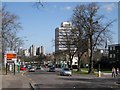
Area Overview for CV1 9ZX
Photos of CV1 9ZX


Area Information
CV1 9ZX is a small residential postcode area in England, home to 2,870 people. It is a compact cluster of flats, reflecting its low home ownership rate of just 9%. The area is characterised by a young demographic, with the median age at 22 and the majority of residents falling within the 15–29 age range. This suggests a community skewed towards students, young professionals, or those in early careers. The presence of Coventry University nearby indicates that the area may attract students or academic staff, though the university itself is not within the postcode. Living here offers proximity to retail and transport hubs, with five major retailers within reach and multiple rail stations nearby. However, the area’s small size and limited housing stock mean it is more of a transient or rental-focused environment than a long-term residential community.
- Area Type
- Postcode
- Area Size
- Not available
- Population
- Not available
- Population Density
- Not available
The property market in CV1 9ZX is dominated by flats, with no data indicating the presence of larger homes or owner-occupied properties. With just 9% of residents owning their homes, the area is overwhelmingly a rental market, likely catering to students or young professionals seeking short-term accommodation. The limited housing stock and small population suggest a niche market, where properties are in high demand but options are constrained. Buyers looking to invest in the area may find opportunities limited to rental properties, though the small size of the postcode means the surrounding area’s housing stock is also likely to be similar. The lack of owner-occupied homes indicates that the area is not ideal for those seeking long-term residency or property value growth.
House Prices in CV1 9ZX
No properties found in this postcode.
Energy Efficiency in CV1 9ZX
Daily life in CV1 9ZX is shaped by its proximity to retail and transport hubs. Residents have access to five major retailers, including Spar, Tesco Coventry, and Sainsburys Coventry, offering convenience for shopping and daily essentials. The area’s rail network, with five stations within reach, provides easy access to nearby towns and cities, supporting both commuting and travel. While the data lists two airports, their practical relevance to residents is uncertain. The lack of local schools or parks means that leisure and family activities may require travel to surrounding areas. Nonetheless, the combination of retail options and transport links offers a functional lifestyle, particularly for those prioritising accessibility over local amenities.
Amenities
Schools
There are no schools explicitly listed in the data for CV1 9ZX, though Coventry University is noted as a nearby institution. This suggests that the area may not be a primary destination for families seeking local schools, and residents may need to look beyond the postcode for educational facilities. The absence of schools in the immediate vicinity could be a consideration for families, requiring reliance on nearby towns or transport links to access schools in other areas. The presence of a university nearby may, however, provide alternative educational opportunities for older students or those pursuing higher education.
| Rank | School | Type | Entry gender | Ages |
|---|
Explore more schools in this area
Go to Schools tabDemographics
The population of CV1 9ZX is predominantly young, with a median age of 22 and the 15–29 age group making up the largest share. Only 9% of residents own their homes, meaning the majority live in rented accommodation. The accommodation type is almost exclusively flats, reflecting a lack of larger family homes or detached properties. The predominant ethnic group is Asian, though specific subgroups are not detailed. This demographic profile suggests a community centred around younger adults, possibly students or those in transient employment. The low home ownership rate and flat-based housing indicate a rental market, which may influence the area’s social dynamics and stability. The absence of detailed deprivation data means it is unclear how economic factors affect quality of life, but the high proportion of young renters implies a need for affordable, short-term housing options.
Household Size
Accommodation Type
Tenure
Ethnic Group
Religion
Household Composition
Age
Household Deprivation
NS-SEC
Explore more demographic insights in this area
Go to Demographics tabPlanning
Planning Constraints
- Flood RiskPremium
- Ramsar Wetland SitesPremium
- Area of Outstanding Natural BeautyPremium
- Protected Nature ReservePremium
- Protected WoodlandPremium