Area Overview for CV1 5TP
Photos of CV1 5TP
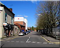
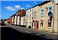
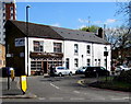
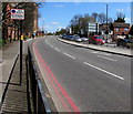
98 photos from this area
Area Information
Key information about the CV1 5TP including its size, population, and administrative classification.
- Area Type
- Postcode
- Area Size
- 7738 m²
- Population
- 1886
- Population Density
- 5596 people/km²
House Prices in CV1 5TP
31
Properties
£68,903
Average Sold Price
£45,000
Lowest Price
£165,000
Highest Price
Showing 31 properties
| Address | Type | Beds | Baths | Last Sale Price | Last Sale Date | |
|---|---|---|---|---|---|---|
| 50 Bretts Close, Coventry, CV1 5TP | Semi-detached | 3 | 1 | £57,750 | Jul 2019 | |
| 6 Bretts Close, Coventry, CV1 5TP | house | - | - | £90,000 | Jul 2018 | |
| 10 Bretts Close, Coventry, CV1 5TP | Terraced | - | - | £65,000 | Jul 2014 | |
| 30 Bretts Close, Coventry, CV1 5TP | house | 4 | - | £126,000 | Apr 2010 | |
| 24 Bretts Close, Coventry, CV1 5TP | Terraced | - | - | £165,000 | Feb 2008 | |
| 16 Bretts Close, Coventry, CV1 5TP | house | - | - | £140,000 | Mar 2007 | |
| 2 Bretts Close, Coventry, CV1 5TP | house | - | - | £45,000 | Sep 2001 | |
| 20 Bretts Close, Coventry, CV1 5TP | house | - | - | £50,000 | Aug 2001 | |
| 14 Bretts Close, Coventry, CV1 5TP | house | - | - | £47,000 | Dec 1999 | |
| 48 Bretts Close, Coventry, CV1 5TP | house | - | - | £50,500 | Feb 1995 |
Page 1 of 4
Energy Efficiency in CV1 5TP
Amenities
Schools
| Rank | School | Type | Entry gender | Ages |
|---|
Explore more schools in this area
Go to Schools tabDemographics
Household Size
One person
most common
Accommodation Type
Flats
most common
Tenure
10
majority
Ethnic Group
black_total
most common
Religion
N/A
most common
Household Composition
N/A
most common
Age
22
median
Adults (30-64 years)
most common
Household Deprivation
N/A
with no deprivation
NS-SEC
9
in Lower managerial occupations
Explore more demographic insights in this area
Go to Demographics tabPlanning
Planning Constraints
- Flood RiskPremium
- Ramsar Wetland SitesPremium
- Area of Outstanding Natural BeautyPremium
- Protected Nature ReservePremium
- Protected WoodlandPremium