Area Overview for CV1 5SP
Photos of CV1 5SP


Area Information
CV1 5SP is a small residential postcode area in England, home to 2,870 people. It is a compact cluster of properties, likely concentrated around specific developments or housing schemes. The area’s demographic profile suggests a youthful population, with a median age of 22 and the majority of residents aged 15–29. This hints at a community shaped by students, young professionals, or those in early careers. The low home ownership rate—just 9%—indicates that most residents rent their homes, with flats being the primary accommodation type. The area’s proximity to Coventry University and nearby rail stations suggests it may cater to students or commuters. While there is no data on historical or cultural landmarks, the area’s connectivity to Coventry’s transport network and retail hubs like Spar and Tesco Coventry positions it as a practical choice for those prioritising convenience over traditional neighbourhood character.
- Area Type
- Postcode
- Area Size
- Not available
- Population
- Not available
- Population Density
- Not available
The property market in CV1 5SP is characterised by a very low home ownership rate—just 9% of residents own their homes. This indicates a rental-dominated market, with flats being the primary type of accommodation. Given the area’s small size and limited data on property listings, it is likely that the housing stock is modest in scale, potentially comprising purpose-built student accommodation or purpose-built flats. For buyers, this suggests a limited pool of owner-occupied properties, with opportunities more likely in the rental sector. The flat-dominated stock may appeal to those seeking affordability or flexibility, but the low home ownership rate also implies that the area is not a traditional buyer’s market. Prospective purchasers should consider the area’s small footprint and its proximity to Coventry’s broader infrastructure when evaluating long-term value.
House Prices in CV1 5SP
No properties found in this postcode.
Energy Efficiency in CV1 5SP
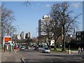
The lifestyle in CV1 5SP is shaped by its proximity to retail and transport hubs. Nearby amenities include Spar, Tesco Coventry, and M&S Coventry, offering everyday shopping and dining options. The rail network provides easy access to Coventry’s central areas and beyond, with stations like Tile Hill Railway Station connecting to broader regional routes. While there is no mention of parks or leisure facilities in the data, the presence of multiple rail stations and retail outlets suggests a convenience-driven lifestyle. The area’s small size means residents may need to venture slightly beyond the postcode for more extensive recreational options, but the immediate vicinity offers practical access to essentials.
Amenities
Schools
The only named educational institution near CV1 5SP is Coventry University, categorised as an ‘other’ type in the data. No primary or secondary schools are listed, which may pose a challenge for families requiring local education for younger children. The absence of schools in the immediate area suggests that residents may need to rely on nearby districts or commute to larger educational hubs. For those prioritising university access, Coventry University’s presence is a clear advantage, but for families with younger dependents, additional research into nearby schools outside the postcode is necessary. The lack of specific Ofsted ratings or school types in the data means the quality of education in the area cannot be assessed directly.
| Rank | School | Type | Entry gender | Ages |
|---|
Explore more schools in this area
Go to Schools tabDemographics
The population of CV1 5SP is overwhelmingly young, with a median age of 22 and the most common age range being 15–29 years. This suggests a community dominated by students, recent graduates, or young workers. Home ownership is exceptionally low at 9%, meaning the majority of residents are renters. Flats are the predominant type of accommodation, reflecting a housing stock likely geared toward affordability or shared living. The predominant ethnic group is Asian_total, though no further breakdown is provided. The absence of specific data on deprivation or income levels means the area’s quality of life cannot be fully assessed, but the high proportion of young adults implies a dynamic, possibly transient population. This demographic profile may influence local amenities and services, which appear to cater to younger, mobile residents.
Household Size
Accommodation Type
Tenure
Ethnic Group
Religion
Household Composition
Age
Household Deprivation
NS-SEC
Explore more demographic insights in this area
Go to Demographics tabPlanning
Planning Constraints
- Flood RiskPremium
- Ramsar Wetland SitesPremium
- Area of Outstanding Natural BeautyPremium
- Protected Nature ReservePremium
- Protected WoodlandPremium