Area Overview for CV1 5BX
Photos of CV1 5BX

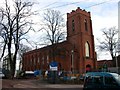
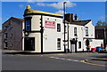
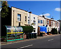
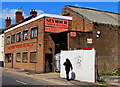
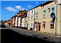
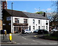
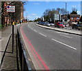
98 photos from this area
Area Information
Key information about the CV1 5BX including its size, population, and administrative classification.
- Area Type
- Postcode
- Area Size
- 9471 m²
- Population
- 2146
- Population Density
- 12009 people/km²
House Prices in CV1 5BX
52
Properties
£79,065
Average Sold Price
£20,000
Lowest Price
£131,000
Highest Price
Showing 52 properties
| Address | Type | Beds | Baths | Last Sale Price | Last Sale Date | |
|---|---|---|---|---|---|---|
| 80 Coronation Road, Coventry, CV1 5BX | Terraced | 2 | 1 | £131,000 | Aug 2021 | |
| 4 Coronation Road, Coventry, CV1 5BX | house | 1 | 1 | £125,000 | Jul 2021 | |
| 88 Coronation Road, Coventry, CV1 5BX | Terraced | 2 | 1 | £107,500 | Nov 2019 | |
| 52 Coronation Road, Coventry, CV1 5BX | Terraced | 2 | 1 | £98,000 | Nov 2017 | |
| 82 Coronation Road, Coventry, CV1 5BX | house | 1 | 1 | £89,950 | Feb 2016 | |
| 94 Coronation Road, Coventry, CV1 5BX | house | 3 | 1 | £70,000 | Sep 2013 | |
| 58 Coronation Road, Coventry, CV1 5BX | Terraced | 4 | 1 | £70,000 | Sep 2011 | |
| 68 Coronation Road, Coventry, CV1 5BX | Terraced | 2 | 1 | £73,500 | Jul 2010 | |
| 60 Coronation Road, Coventry, CV1 5BX | Terraced | 2 | 2 | £87,250 | Apr 2009 | |
| 56 Coronation Road, Coventry, CV1 5BX | Flat | - | - | £90,000 | Feb 2009 |
Page 1 of 6
Energy Efficiency in CV1 5BX
Amenities
Schools
| Rank | School | Type | Entry gender | Ages |
|---|
Explore more schools in this area
Go to Schools tabDemographics
Household Size
Family (3-5 people)
most common
Accommodation Type
Houses
most common
Tenure
24
majority
Ethnic Group
White
most common
Religion
N/A
most common
Household Composition
N/A
most common
Age
22
median
Adults (30-64 years)
most common
Household Deprivation
N/A
with no deprivation
NS-SEC
9
in Lower managerial occupations
Explore more demographic insights in this area
Go to Demographics tabPlanning
Planning Constraints
- Flood RiskPremium
- Ramsar Wetland SitesPremium
- Area of Outstanding Natural BeautyPremium
- Protected Nature ReservePremium
- Protected WoodlandPremium