Area Overview for CV1 5BJ
Photos of CV1 5BJ

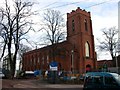
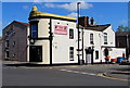
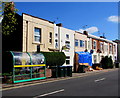
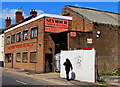
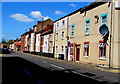
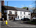
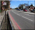
98 photos from this area
Area Information
Key information about the CV1 5BJ including its size, population, and administrative classification.
- Area Type
- Postcode
- Area Size
- 5357 m²
- Population
- 2146
- Population Density
- 12009 people/km²
House Prices in CV1 5BJ
47
Properties
£102,250
Average Sold Price
£11,000
Lowest Price
£240,000
Highest Price
Showing 47 properties
| Address | Type | Beds | Baths | Last Sale Price | Last Sale Date | |
|---|---|---|---|---|---|---|
| 48 King Edward Road, Coventry, CV1 5BJ | Terraced | 2 | 2 | £157,000 | Jul 2025 | |
| 72 King Edward Road, Coventry, CV1 5BJ | Terraced | 2 | 1 | £101,500 | Dec 2023 | |
| Flat, 122 King Edward Road, Coventry, CV1 5BJ | Terraced | 5 | 5 | £217,000 | Feb 2022 | |
| 122 King Edward Road, Coventry, CV1 5BJ | Terraced | 5 | 5 | £217,000 | Feb 2022 | |
| 98 King Edward Road, Coventry, CV1 5BJ | Terraced | 3 | 1 | £182,750 | Oct 2020 | |
| 58 King Edward Road, Coventry, CV1 5BJ | Terraced | 3 | 1 | £135,000 | Jun 2019 | |
| 100 King Edward Road, Coventry, CV1 5BJ | Terraced | 1 | 1 | £240,000 | Dec 2018 | |
| 56 King Edward Road, Coventry, CV1 5BJ | Terraced | 3 | 2 | £152,000 | Jul 2018 | |
| 124 King Edward Road, Coventry, CV1 5BJ | Terraced | 4 | 1 | £123,000 | Sep 2015 | |
| 68 King Edward Road, Coventry, CV1 5BJ | house | - | - | £75,000 | Apr 2014 |
Page 1 of 5
Energy Efficiency in CV1 5BJ
Amenities
Schools
| Rank | School | Type | Entry gender | Ages |
|---|
Explore more schools in this area
Go to Schools tabDemographics
Household Size
Family (3-5 people)
most common
Accommodation Type
Houses
most common
Tenure
24
majority
Ethnic Group
White
most common
Religion
N/A
most common
Household Composition
N/A
most common
Age
22
median
Adults (30-64 years)
most common
Household Deprivation
N/A
with no deprivation
NS-SEC
9
in Lower managerial occupations
Explore more demographic insights in this area
Go to Demographics tabPlanning
Planning Constraints
- Flood RiskPremium
- Ramsar Wetland SitesPremium
- Area of Outstanding Natural BeautyPremium
- Protected Nature ReservePremium
- Protected WoodlandPremium