Area Overview for CV1 4YJ
Photos of CV1 4YJ


Area Information
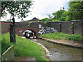
CV1 4YJ, part of Radford in Coventry, is a small residential cluster with a population of 1,813, nestled 1.5 miles north of the city centre. Its history is deeply tied to the British motor car industry, with the former Daimler and Jaguar factories shaping its industrial legacy. Today, the area blends suburban living with pockets of historical infrastructure, such as the Radford Brook culvert and the Electric Wharf development. The community is defined by its proximity to Coventry’s transport networks, including multiple railway stations and the Coventry Canal. Daily life here is influenced by its industrial past, with a mix of older flats and semi-detached homes. While the area has seen a decline in council housing since the 1980s, it remains a practical choice for those seeking affordable accommodation near city amenities. Its small size means residents are close to Coventry’s cultural and commercial hubs, though the character of the area is shaped more by its historical roots than modern expansion.
- Area Type
- Postcode
- Area Size
- Not available
- Population
- Not available
- Population Density
- Not available
The property market in CV1 4YJ is characterised by a low home ownership rate (15%) and a predominance of flats, reflecting a rental-focused environment. This suggests that the area is more suited to renters than owner-occupiers, with limited opportunities for long-term property investment. The housing stock includes both former council properties and privately owned flats, though the latter are rare. The small area’s limited size means the immediate surroundings offer few alternative housing options, making it a niche market. For buyers, the scarcity of owner-occupied properties may present challenges, though the flat stock could appeal to those seeking affordable, low-maintenance living. The area’s proximity to Coventry’s transport links and amenities may offset its lack of traditional homeownership appeal, but the rental market’s dominance indicates a focus on short-term affordability over capital growth.
House Prices in CV1 4YJ
No properties found in this postcode.
Energy Efficiency in CV1 4YJ
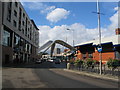
Living in CV1 4YJ offers access to essential amenities within practical reach. The area is served by five retail outlets, including Tesco Coventry, Sainsburys Coventry, and Iceland Coventry, ensuring everyday shopping needs are met. Three railway stations—Canley, Coventry Arena, and Tile Hill—provide regular connections to Coventry’s cultural and commercial districts. The Coventry Canal, though not currently navigable, adds to the area’s historical charm. Nearby, the Electric Wharf development offers a mix of residential and business spaces, while the Radford Brook culvert and Nauls’ Mill Park provide green spaces for leisure. The war memorial, unveiled in 1919, stands as a local landmark. While the area lacks large-scale leisure facilities, its proximity to Coventry’s city centre means residents can access theatres, museums, and dining venues within a short journey. The combination of practical amenities and historical features creates a distinct lifestyle for those prioritising affordability and connectivity.
Amenities
Schools
| Rank | School | Type | Entry gender | Ages |
|---|
Explore more schools in this area
Go to Schools tabDemographics
The population of CV1 4YJ is 1,813, with a median age of 47, indicating a community skewed towards middle-aged adults (30–64 years). Home ownership here is low, at 15%, suggesting a rental-dominated market. The predominant accommodation type is flats, reflecting a housing stock shaped by post-war developments and council housing. The area’s ethnic composition is predominantly White, though specific data on diversity is not provided. The age profile suggests a stable, established population, with fewer young families or retirees compared to other parts of Coventry. The low home ownership rate may impact long-term investment value, while the flat-dominated housing stock caters to those seeking affordable, manageable living spaces. The absence of detailed deprivation data means the quality of life remains to be fully contextualised, but the age range implies a community with established local ties.
Household Size
Accommodation Type
Tenure
Ethnic Group
Religion
Household Composition
Age
Household Deprivation
NS-SEC
Explore more demographic insights in this area
Go to Demographics tabPlanning
Planning Constraints
- Flood RiskPremium
- Ramsar Wetland SitesPremium
- Area of Outstanding Natural BeautyPremium
- Protected Nature ReservePremium
- Protected WoodlandPremium