Area Overview for CV1 4NU
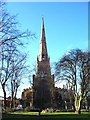
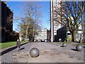
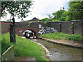
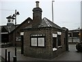
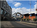
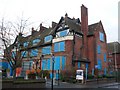
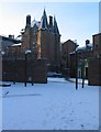
Photos of CV1 4NU


Area Information
CV1 4NU is a compact residential postcode in north Coventry, encompassing parts of Foleshill and Little Heath. Covering just 1.2 hectares, it is densely populated, with 1,610 residents packed into 131,658 people per square kilometre. This small area reflects Coventry’s industrial past, with roots tracing back to the 11th century and a history of ribbon weaving, canals, and manufacturing. Today, it is a mixed-use neighbourhood with a strong presence of houses, though home ownership is low at 28%, suggesting a rental-heavy market. The area’s character is shaped by its proximity to Foleshill Road and Stoney Stanton Road, historic routes that once connected rural Warwickshire to Coventry. While it lacks green spaces, its transport links and proximity to retail hubs make it practical for daily life. The community is predominantly Asian, with a median age of 22, but the most common age group is 30–64, indicating a mix of young professionals and established families. Living here means navigating a tight-knit, high-density environment with a legacy of industry and social housing.
- Area Type
- Postcode
- Area Size
- 1.2 hectares
- Population
- 1610
- Population Density
- 5567 people/km²
The property market in CV1 4NU is characterised by a low home ownership rate of 28%, suggesting that most residents rent rather than own their homes. The accommodation type is predominantly houses, which is unusual for a high-density area, indicating a mix of older, larger properties and newer builds. This combination may appeal to families seeking more space, though the limited area size of 1.2 hectares means housing stock is constrained. Buyers should consider the competitive rental market and the potential for limited availability of owner-occupied homes. The area’s industrial heritage may influence property values, with some homes located near former manufacturing sites. For those seeking a home, the proximity to transport links and schools is a key draw, but the small footprint of the postcode means buyers must look closely at nearby areas for more options.
House Prices in CV1 4NU
No properties found in this postcode.
Energy Efficiency in CV1 4NU
Residents of CV1 4NU have access to essential retail amenities, including Tesco Coventry, Sainsburys Coventry, and Co-op Coventry, all within walking or short driving distance. The area’s rail stations—Canley, Coventry Arena, and Tile Hill—offer convenient links to employment hubs and leisure destinations. While there are no named parks or recreational spaces in the data, the proximity to Foleshill Road and Stoney Stanton Road suggests potential for local walks or community events. The presence of two airports, though not specified as major hubs, may provide travel options for residents. The mix of retail, transport, and nearby schools creates a practical lifestyle, though the high density and industrial heritage may limit green spaces. For those prioritising convenience over tranquillity, this area offers a functional, accessible environment.
Amenities
Schools
Residents of CV1 4NU have access to a range of primary schools, including John Gulson Primary School, John Gulson Junior School, and John Gulson Infant School, all of which are primary institutions. The John Gulson Primary School holds a good Ofsted rating, while Eden Girls’ School, Coventry, an academy with an outstanding Ofsted rating, serves older students. There is also Coventry Hospital School, a special needs institution. This mix of primary and special schools offers families flexibility, though the absence of secondary schools within the postcode means older students may need to commute. The presence of an outstanding academy suggests strong educational options for those willing to travel, but the lack of local secondary schools could be a drawback for families prioritising convenience.
| Rank | School | Type | Entry gender | Ages |
|---|
Explore more schools in this area
Go to Schools tabDemographics
The population of CV1 4NU is 1,610, with a median age of 22, though the most common age range is 30–64. This suggests a mix of younger residents and middle-aged families, likely tied to nearby employment opportunities. Only 28% of homes are owner-occupied, indicating a rental-dominated market, which may reflect the area’s history as a post-war social housing hub. The predominant ethnic group is Asian, highlighting a distinct cultural identity. The high population density of 131,658 people per square kilometre means living spaces are closely packed, which can impact privacy and noise levels. For families, this density may limit access to larger homes, though the area’s 28% home ownership rate implies many residents rent. The demographic profile points to a community shaped by migration and economic shifts, with a focus on affordability over property investment.
Household Size
Accommodation Type
Tenure
Ethnic Group
Religion
Household Composition
Age
Household Deprivation
NS-SEC
Explore more demographic insights in this area
Go to Demographics tabPlanning
Planning Constraints
- Flood RiskPremium
- Ramsar Wetland SitesPremium
- Area of Outstanding Natural BeautyPremium
- Protected Nature ReservePremium
- Protected WoodlandPremium