Area Overview for CV1 4JR
Photos of CV1 4JR

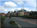
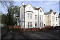
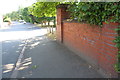
100 photos from this area
Area Information
Key information about the CV1 4JR including its size, population, and administrative classification.
- Area Type
- Postcode
- Area Size
- 7146 m²
- Population
- 1987
- Population Density
- 4508 people/km²
House Prices in CV1 4JR
32
Properties
£62,275
Average Sold Price
£14,500
Lowest Price
£148,000
Highest Price
Showing 32 properties
| Address | Type | Beds | Baths | Last Sale Price | Last Sale Date | |
|---|---|---|---|---|---|---|
| 27 Matlock Road, Coventry, CV1 4JR | Terraced | 2 | 1 | £147,000 | Jun 2025 | |
| 49 Matlock Road, Coventry, CV1 4JR | Terraced | 3 | 1 | £117,500 | Apr 2025 | |
| 11 Matlock Road, Coventry, CV1 4JR | Terraced | 2 | 1 | £120,000 | Sep 2019 | |
| 59 Matlock Road, Coventry, CV1 4JR | Terraced | 3 | 1 | £148,000 | Mar 2018 | |
| 21 Matlock Road, Coventry, CV1 4JR | Terraced | 2 | 2 | £70,000 | Jan 2016 | |
| 31 Matlock Road, Coventry, CV1 4JR | Terraced | 2 | - | £80,500 | Dec 2014 | |
| 19 Matlock Road, Coventry, CV1 4JR | house | 2 | 1 | £75,000 | Oct 2013 | |
| 3 Matlock Road, Coventry, CV1 4JR | Terraced | 3 | - | £69,950 | Aug 2009 | |
| 29 Matlock Road, Coventry, CV1 4JR | Terraced | 2 | 1 | £70,000 | May 2004 | |
| 13 Matlock Road, Coventry, CV1 4JR | Terraced | - | - | £63,000 | Aug 2003 |
Page 1 of 4
Energy Efficiency in CV1 4JR
Amenities
Schools
| Rank | School | Type | Entry gender | Ages |
|---|
Explore more schools in this area
Go to Schools tabDemographics
Household Size
Family (3-5 people)
most common
Accommodation Type
Houses
most common
Tenure
30
majority
Ethnic Group
White
most common
Religion
N/A
most common
Household Composition
N/A
most common
Age
22
median
Adults (30-64 years)
most common
Household Deprivation
N/A
with no deprivation
NS-SEC
16
in Lower managerial occupations
Explore more demographic insights in this area
Go to Demographics tabPlanning
Planning Constraints
- Flood RiskPremium
- Ramsar Wetland SitesPremium
- Area of Outstanding Natural BeautyPremium
- Protected Nature ReservePremium
- Protected WoodlandPremium